Feeds:
Posts
Comments

Archive for the ‘general seamanship’ Category

SAFER SEAS-11.01.2018The latest NTSB document on vessel casualty investigations delivers insights into the chain of errors that result in the bad things happening.  Read, explore and appreciate the observations made and the cost of these error chains.

Read Full Post »

https://gcaptain.com/kayakers-collide-new-york-ferry/

I would like to offer my condolences on both sides of this incident, no one wants to see this happen.

I have commented on this in the past discussing the lack of communication between recreational vessels and kayaks specifically.

https://captbbrucato.wordpress.com/2011/07/05/really-kayaks/

https://captbbrucato.wordpress.com/2011/07/06/kayaks-redux/

I’ve had an ongoing discussion in my comment section as a result of my post regarding the same.  Let’s take a moment to clear up a few things I’m seeing in the comment sections of the many posts floating around trying to assess blame, cause, and right of way.

The rules are specific and if followed, the thinking is (theoretically) that a collision should never occur.  Real world, not so much.


Rule 9 – Narrow Channels Return to the top of the page

(a) (i) A vessel proceeding along the course of a narrow channel or fairway shall keep as near to the outer limit of the channel or fairway which lies on her starboard side as is safe and practicable.

International Inland
(ii) Notwithstanding Rule 9(a)(i) and Rule 14(a), a power-driven vessel operating in narrow channel or fairway on the Great LakesWestern Rivers, or waters specified by the Secretary, and proceeding downbound with a following current shall have theright-of-way over an upbound vessel, shall propose the manner and place of passage, and shall initiate the maneuvering signals prescribed by Rule 34(a)(i), as appropriate. The vessel proceeding upbound against the current shall hold as necessary to permit safe passing.

(b) A vessel of less than 20 meters in length or a sailing vessel shall not impede the passage of a vessel [ which | that ] can safely navigate only within a narrow channel or fairway.

(c) A vessel engaged in fishing shall not impede the passage of any other vessel navigating within a narrow channel or fairway.

(d) A vessel [ shall | must ] not cross a narrow channel or fairway if such crossing impedes the passage of a vessel which can safely navigate only within that channel or fairway. The latter vessel [ may | must ] use the signal prescribed in Rule 34(d) if in doubt as to the intention of the crossing vessel.

(e)

(i)  In a narrow channel or fairway when overtaking [can take place only if the vessel to be overtaken has to take action to permit safe passing, the vessel intending to overtake |  the, power-driven vessel intending to overtake another power-driven vessel] shall indicate her intention by sounding the appropriate signal prescribed in [Rule 34(c)(i) | Rule 34(c)] [and take steps to permit safe passing]. The [power-driven] vessel [to be |being] overtaken, if in agreement, [shall] sound the [appropriate | same] signal [prescribed inRule 34(c)(ii)] and [may, if specifically agreed to,] take steps to permit safe passing. If in doubt she [may | shall] sound the signals prescribed in Rule 34(d).

(ii) This rule does not relieve the overtaking vessel of her obligation under Rule 13.

(f) A vessel nearing a bend or an area of a narrow channel or fairway where other vessels may be obscured by an intervening obstruction shall navigate with particular alertness and caution and shall sound the appropriate signal prescribed in Rule 34(e).

(g) Any vessel shall, if the circumstances of the case admit, avoid anchoring in a narrow channel.

My view, find the kayaks.  Get it?

5 31 10 bbrucato  DSCF0174r

And here is an example of what the prospective traffic can be..

It has been cited that rule 9c applies, in this case it does not.

It has been claimed this was a narrow channel, it is not.

It has been stated the “rule of tonnage” should have applied.  There is no such rule.  It is a construct of common sense similar to “let the big boat go first”, it is not a rule, reg, or statute.  It is a common sense admonition for small craft surviving encounters with large vessels in close quarters.

So far as I know, what has been reported is that the ferry was leaving his berth and turned into the sun for his westbound crossing and met with a flotilla of kayaks that were following the pier-heads close in.  Was there any communication from the kayaks? So far, unknown.  Did the ferry sound signals properly? Too early in the investigation and no one has said that he didn’t.  Were the kayaks being led by a club or organization?  Was there notice given to VTSNY (USCG Vessel Traffic Service)?  All this and more will come out in due course.  It is cold comfort that no one died, I take no pleasure in my prediction that this was a matter of “when ” as opposed to “if” it might happen.

For those of you who follow this blog, I ask that we all make an effort to educate those recreational boaters of their need to understand the dynamics of sharing the waterways in a safe manner and comply with the rules.

I see quite a few professionals misquoting the rules as well, this is not acceptable.

As professionals we are held to the higher standard and will suffer as well as impose suffering on others for our ignorance.  The hearing will not be pretty when it becomes apparent that our industry isn’t upholding the standard that sets us apart.

We must do better.

http://www.navcen.uscg.gov/?pageName=navRulesContent

Read and understand the “Rules”


, it’s clear there is a need to post this again.

Read Full Post »

It’s been a few months and the weather conditions down here in the Gulf of Mexico continue to offer a diverse experience from one voyage to the next. Here’s what we had to deal with for a day and a half just before the Thanksgiving Holiday.  What you’re watching is what an ATB is designed to do, ride weather that would keep a conventional tug and barge hove to on a slow ahead engine or weather bound all together.   We don’t necessarily enjoy this kind of ride, but the fact the ATB tolerates this kind of weather and is still able to make a respectable amount of headway is testament to the effectiveness of the design.


The Nicole L. Reinauer heading for Tampa, Florida on a stormy day…. from Bill Brucato on Vimeo.

Read Full Post »

IMAG1694_stitch

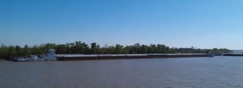
A line tow ready to head upriver, his length overall is about 1,500 feet and maybe 120′ wide.

I have to admit I’m a bit of a tourist these days.  My latest assignment has my boat trading between New Orleans and Florida.  As I write this we’re waiting to get a loading berth in the NORCO terminal just above the Crescent City.

While I’ve been around tugs and tows my entire career I’ve never had the experience of seeing a Mississippi river tow built and then sailed by the massive towboats that navigate the lifeline of the mid-west.  It’s busy work and takes a lot of blood and sweat to put together.  It can take a day or two to build a “line tow” by small workhorse towboats that are in constant motion picking up, shifting and rafting up a fleet of 28 or more barges carrying anything from coal to grain to whatever.  The towboats that move the finished tow are huge and wide with a good amount of horsepower in the engine room and the pilothouse.

Listening to these boats receiving their marching orders is interesting, the numbers and types of barges vary from boxes to rakes and keeping track of where they are placed and how they are delivered is complex but well understood.  It reminds me of how my Dad used to get his orders moving railroad floats for the New York Central when I was a boy just riding along.  The numbers of each unit are conveyed in a boatman’s shorthand, concise and exact.

The volume of traffic here is amazing. Ships, sea-going and river tows are everywhere.  Huge cranes off-loading dry cargo, flotillas of barges are almost everywhere along the riverbank.  The anchorages are along the river and tightly packed.  Our anchorage here in Ama one of many.   We set our anchor within a few dozen yards of the unit ahead of us and settle back.  The river current is constant so we lay parallel with the bank.  It’s a bit unsettling to be this close to the guy ahead of us and the one behind us, but the anchor holds and it’s kinda cozy.

The radio chatter is flavored with a bit of a patois and it’s amusing to hear some of the exchanges between the pilots and operators of the boats working here.  Courteous and occasionally colorful these fellows use phrases that catch your attention.  In a conversation between a couple of units this morning the dialog went something like this;”I’m up-bound approaching the turn, what would you like?” If you could hold up there I’ll be around here shortly”, “No problem cap, I can do anything but disappear.”  You can be sure I’ll be using that one someday.

It’s not news to anyone that’s the least bit familiar with the western rivers that the “line tows” are massive floating collections of cargo larger and longer than any ship afloat.  To listen to these units making their way is a study in “cool and calm”.  When I encountered my first big guy, I was impressed  with the way he seemed to manage his charges so effortlessly.  I quickly recognized that these men were supremely gifted boat handlers and to underestimate them would be foolish.

For the time being, I’m going to enjoy the experience and absorb as much as I can from the mariners that work in this corner of the country.  These people have a skill set that rivals any you might find in the Northeast.

During my first voyage here one of our river pilots came aboard to relieve his colleague who had met us at the entrance to the river eight hours earlier.  As we shook hands and in a big voice he said “Cap, your day just got better”, better indeed.

More to come.

Read Full Post »

We seem to take for granted the learning process when it comes to many things, not the least of which includes our physical motor skills and our cognitive ability to quantify a situation as good or bad.  Let’s take walking for example, you learn how to balance and toddle along very young, much to your mother’s delight.  Soon after that, the joyful look on Mom’s face becomes terror when you’ve learned how to run, and of course, you run with abandon everywhere.   You haven’t learned when it’s okay to run, you just run.  But in trying to teach you, Mom and Dad had to let you take a couple of  falls. Soon enough you get the idea that running is good some of the time, but not a good idea all of the time.  The first time you touch something hot serves a painful lesson, but it’s then we learn that fire is hot and ice is cold.  All the skills we acquire as we grow lead us to becoming an adult with the capacity to view our world as a collection of safe/unsafe, fun/scary, dangerous/fun or stupid moves.

“The triple bridges up the Hackensack closed on him after giving him permission to proceed. This was about 2 am and everything up there is pitch black. As soon as he realized the bridge was coming down, he threw it into full reverse, but it wasn’t soon enough. He did lose his job but the USCG did not take any action against him. They had the radio conversation on tape and exonerated him.”

When in comes to tugs and tows one could spend all day describing the mind-set needed by a boat handler but in the end it has to be learned.  The training wheels come off pretty early and the actual boat handling begins  as soon as the ticket  is in hand.  The hard part isn’t what one might think, it’s not the timing of the throttle or depth perception, it’s situational awareness.

All of the things that come into play while maneuvering a tug and tow for transits, docking, sailings, or re-configuring are subject to being re-evaluated as they progress or deteriorate using every input, hunch, suspicion, or sensation. Recognizing that things have gone bad is not easy.  You’d think it would be in your gut, but novice boat handlers don’t have the judgement or experience that exposes the “bad stuff” early in the maneuver. Knowing when to pull the plug is the hard part.  Recognizing it too late and then pushing a bad situation in the hopes of saving the day will end badly.  So it serves a boatman to understand his limitations well before any operation is undertaken.  Proper planning prevents piss poor performance.

The towing industry is a contact sport, shit happens and we’ve all had our share of “bell ringers” and bad days.  The key is to learn from them.  But, recognizing the threshold of disaster is a difficult matter when it comes to to training someone for it.  In order to make that determination, you have to see things go bad and “live it”.  That threshold  is usually reached well before things go wrong.  The chain of failure starts earlier than one might think (these days referred to as the “root cause”).  When a novice is training he practices voyage planning, sailings,  transits, and dockings.  He or she is watched and guided to safely execute the maneuvers, but they need to be allowed to screw it up (to a point).  The best lesson is one that has some “pucker factor” at work.  The greater the “pucker”, the more unforgettable the lesson.

The mark of a mature boatman is apparent when and how he deals with a bad situation.  Any novice who’s had a bit of time behind the wheel can sail and dock a barge when conditions are ideal.  The test comes when everything you thought you knew comes up short, then the fact that you won’t do anything new in an emergency becomes evident.  How you handle an adverse turn of events comes from learning how to expect the unexpected and being prepared to deal with it.

One of the most important skills is to know is when to start over.  It’s “plan B”.

The saying; “Physics is a bitch” couldn’t be more accurate.  The behavior of the tow’s mass and inertia can be calculated and parsed to the nth degree.  But who really does that?  Well actually we do, when we check the current, wind, traffic, and our gut. Quoting a post in the Captain forum from a Captain to a new mate, “Son, never approach a dock faster than you’d want to hit it”.  The approach and landing is generally a controlled crash.  We’re talking inches per second.

Ebb current rounding Tremley Point and losing it in the turn brought this one to a sudden stop. It made one Hell of an “impression”.

Giving thought to how we should proceed involves planning for as many contingencies as we can think of.  Time on deck provides the means to acquire that judgement.  But watching someone having a bad day is not as indelible as having the bad day yourself.  That crystalline intensity isn’t there.

Every deckhand with some time under his belt utters the same monologue when the pilothouse is having a problem.  He knows exactly where the poor bastard went wrong and has the answer to all things “tugboat” until he himself is at the helm envisioning all too late what he should have done.  There isn’t a working boatman alive that can claim he has never had a reportable damage. You can’t be in this industry and not have had an incident.  It’s the nature of the job.  Incidents that don’t get you or anyone else killed or maimed serve as educational opportunities.  You (hopefully) never forget the “lesson learned”.

With luck and determination, a good number of candidates for the wheelhouse survive their “baptisms by fire” and turn out to be competent and capable boat-handlers.  Most recognize that their careers are ongoing educational seminars at “Tugboat U”.   The number of years one is on the job is not insurance against error.  Even with 30+ years at the wheel, errors occur.   They don’t happen as often, but they happen none the less.  Overestimating rudder power and underestimating the wind could turn a simple approach to an “all astern frantic” exercise.  With luck it becomes a footnote and lesson learned, catch it too late, disaster.

Allowing for error during training is one of the most difficult lines to walk in this business.  Every trainer has a different comfort level and each trainee is unique. Some are granted a bit more leash  while others are held a little more tightly until their skills improve and allow for more freedom from intervention. Overall, the aim is to expand the limits of one’s skill level when it comes to error management.  The only practical way to do that is to let the situation develop and address it.  If you haven’t been allowed to deal with a bad situation, you’ll never be able to defuse one.  It sounds like a “Catch 22” but the many factors that have an effect on decision making can’t be listed in a curriculum.

The U.S. Navy has intensive and expensive training for damage-control and fire fighting.  They practice air combat maneuvers and test the mettle of their people in relatively controlled environments.  The intensity of having water up to your ass while you plug a hole in the hull or flames licking at your heels knocking down an engine room fire, or someone at your six with “missile lock”.  It’s about as real as it can get, but it’s still a training exercise.  The ship isn’t really sinking or afire and that missile isn’t really heading for your tailpipe.

On tugs, we have to create these training opportunities as we work.  We don’t have the luxury of the reset button.  The set-up and execution of specific maneuvers are conducted in the real world with little room for dramatic errors.   Some elements are frequently encountered during the hitch.  We see wind, current and traffic every day.  We deal with strange berth assignments that test our close quarter maneuvering skills daily.  We utilize assist boats not too differently than docking masters on large ships.  When an assist boat is used, the equation now includes another whole set of considerations.  Not the least of which would be keeping it in position safely and using it to its greatest advantage.  All of these skills are learned on the job, not in school.

It’s been mentioned that simulators would be useful in giving wheelhouse candidates a safer environment to experience their “Kobiyashi Maru Incident”.  I can agree to a point, the quality of simulators has improved dramatically in the last ten years but the reset button is still there.  It’s an expensive course of limited value in my opinion.  I can’t say that I would have a lot of  faith in a trainee telling me that he had the high score on the simulator as we are on approach to Hell’s Gate drawing 25′ at max flood, eastbound, meeting a westbound deep draft sailboat in mid-channel.  There’s a whole lot more at stake then a grade at that point.

Read Full Post »

It’s old news now, for all intents and purposes L.O.R.A.N. is dead.  Aside from the arguments for or against shutting down the system, it’s fait accompli, the deed is pretty well done.

I’ve read the articles filled with the hand wringing and gnashing teeth of how the system should be left in place as a back-up in case of whatever….hey waitaminit,  what “backed up” L.O.R.A.N.?  Should we set up radio beacons again and fire up the old  R.D.F.?  Have you seen a working R.D.F. on anything afloat besides a vintage Russian Spy Ship lately?

In fact, most coastal charts don’t have the grid anymore unless it’s a special order or an antique.   If you still have a L.O.R.A.N., how often have you used it since adding G.P.S.?  I haven’t seen a L.O.R.A.N. unit aboard for at least 8 years, I don’t miss it.   It was easy enough to use the TD’s but once G.P.S. was in the game it was the hands down winner.  Yes we depend on it, yes we move bigger stuff with closer tolerances, it was a natural progression.

Could it be that our chart-plotters and all the sophisticated A.I.S. coupled devices we use are now one solar flare, a spilled cup of coffee, or government whim away from non-existence?

Is it possible that our navigation technology, so intimately wrapped up in those tidy little G.P.S. receivers, may fail or be taken away at the worst possible moment?    Well duh…  that’s always been true, as with any electronic aid.  We’ve talked about this before.

You’re not supposed to be relying on any one aid for navigation, no matter how slick it is.   The nav-discipline you exercise while underway should use everything at your fingertips.  Some more than others, but none more than your ability to recognize the limitations of each tool.  When it comes to your piloting discipline, no battery back-up or antenna is required.

You need an up-to-date chart, a decent stabilized radar, a good grasp of D.R. plotting, and a sharp pencil.  Plotting D.R.’s and detailed voyage planning are just prudent procedures. Professionals prepare a full fledged voyage plan.  The voyage plan by definition is a working document and it is adjusted as the voyage progresses.

The idea of plodding ahead without keeping track of where I’ve been and where I expect to be has not entered the equation since detailed voyage planning has been made part of our operational procedures.  Whether I put a mark on the chart or make a note, there is a record of where I’ve been within the last 30 minutes to refer to.  Be it a landmark, bearing and distance, L.O.P., or radar range and bearing.

Sooner or later, something will stop working as it should, and even if every layer of “e-redundancy” fails, one can still have enough recent data to discern a decent estimated position when all of the e-toys fail.

It’s easy to be lulled into a false sense of security when you’ve got the magic box telling you what you want to hear, even when your eyes would tell a different story.   With electronics, chart plotters, and A.I.S. in agreement, few would doubt their position, but we shouldn’t be missing that healthy dose of skepticism.  Scanning the instruments and looking out the window are practices hard-linked to safe navigation especially while piloting. To rely completely on any one tool means you’re shit out of luck when that tool fails.

Devices go out of whack for the strangest and sometimes the simplest reasons. The story and subsequent investigation of the cruise ship Royal Majesty’s grounding on Rose and Crown Shoal off Nantucket was reported to be partly the result of the navigation officers assuming their electronic information was gospel.  That assumption contributed to the events that turned a routine trip into a nightmare.  Among the critical things they missed was the alarm on the master G.P.S. unit indicating that it had switched to D.R. Mode (due to a faulty antenna).  Even with a L.O.R.A.N. unit (which they apparently ignored) integrated into their navigation suite, they went aground 17nm off course.  Okay, so they weren’t piloting, but they had an operational L.O.R.A.N. and didn’t recognize their navigation error until they were making lobster salad on Rose and Crown.  A couple of L-plots may have clued someone in.

“Things to consider“:

1. Fathometers:

While stopped with no way on, a fathometer will only tell you what’s under the transducer at that moment, add a few knots of speed and you’ll be able to identify a trend (shoaling or deepening), but prop-wash turbulence from another vessel (or your own), or choppy seas can obscure accurate readings.   Fathometers generally display the depth under the keel as the default display.

2. A.I.S.:

An A.I.S. transponder can and will display incorrect data if it hasn’t been set up or updated properly.  There’s no way to be certain the transmitted A.I.S. data is correct unless you confirm it the old fashioned way, plot it.  Determining a C.P.A. using only A.I.S. data is a fool’s errand.

3. G.P.S. Chartplotters:

Chart plotters rely on static data for charts(vector or raster) and some can be updated online with the latest corrections, but even if you have a “state of the art” device,  your chart plotter may not reflect the most up to date bouyage or navigation information.  It isn’t gospel…..and we all know how Windows based systems can be, shall we say, fickle.

4. Radar:

Radar is a simple concept of reflection.  It is still in use as a critical and necessary tool while R.D.F.’s, Omega, and L.O.R.A.N. (both A and C) have fallen by the wayside.   It’s limitations are mostly related to signal attenuation, clutter caused by sea-state, precipitation, or user error. Since radar is a “line of sight” device,  it’s limited by it’s geographic horizon.  The biggest problem with Radar is mis-interpretation of the data presented, that’s why we’re required the radar course for our licenses.  See Big Bayou Canout.  See Andrea Doria.

Radar navigation is more than just plotting vectors for collision avoidance and identifying landmarks by their profile, it’s a skill that backs up our piloting and position fixing.  I can honestly say that for my work,  collision avoidance plotting on paper is way down the list as far as how I use radar in my “day-to-day”.

Targets can be missed if they are low to the water, have non-metal reflective surfaces, or are over the horizon.  The distinction of this device is that it updates with every swing of the scanner, BUT unless you are stopped and making no way, it tells you where you were, not where you are.

For coastal navigation and inland piloting, radar fixes are useful tools and are not dependent on anything except the skill of the operator, a gyro compass, and the power supply.  A stabilized display that produces a bearing line using the E.B.L. function (electronic bearing line) is a tried and true method of taking bearings.  Two good bearings to fixed objects ashore at or near 90 degrees apart = a fix.  No G.P.S. info or pelorus is necessary.

radar fix generated by taking a range and bearing to a known fixed object (lighthouse, beacon, point of land, or dock) or swinging a couple of arcs using the V.R.M. gives us a pretty accurate indication as to where we are.  From that point (rfix) we can lay off our planned course and speed on the chart and have a reliable graphic representation of our position in relation to all around us.  Plotting using this method is a solid means of position fixing.  But it’s only good at the moment of the fix, introduce any change and it isn’t accurate any longer.  Those changes include but are not limited to, speed of advance, changes in current, wind direction, and time. After that it’s a D.R Plot until the next fix.

Parallel indexing is another, frequently overlooked function of modern radar.  It’s a simple method of determining the “set” on or off a coast or hazard.  It enables a quick visual reference to the user without making any calculations, if a target or hazard is inside the index line, we’re closing, outside we’re falling away.

Radar may not be as sophisticated as the new plotters and it takes practice, but it’s a good basic tool.  I regularly deal with multiple targets, large and small, going at different speeds and courses in close quarters.  Sometimes one needs to be a bit clairvoyant in order to make any sense out of what is on the screen and what those targets have in mind.  It’s up to me to know, as best as I can, where I am and what I can do to avoid getting too “up close and personal”.  The best defense I can have is using every device I have at hand along with a good pair of eyes and the sense to use them.

Using radar as a position fixing aid should be a regular part of the nav-watch’s procedures.  When you have the luxury of taking a certain route regularly, the picture on the display becomes familiar enough to pick out subtle differences between the buoys, shoreline, and potential traffic.

I’m aware that at any moment my boat or the one I’m approaching could suffer an equipment failure that will impact my decisions. Maintaining one’s situational awareness includes keeping a solid “plan b” in mind.

5. E.C.D.I.S. (Electronic Chart Display Information Systems)

For the most part, these devices are on ships rather than tugs due to their high price.  They’re supposed to be the ultimate in “networked navigation devices”.  Radar, A.I.S., G.P.S., fathometer, chart-plotter, A.R.P.A and more, are all rolled into one.  If there are two complete and independent installations on board, the vessel can sail without a paper chart catalog.  The database can be updated with the click of a mouse, but it’s still something that needs to be treated with a grain of salt.

And if one needed any more proof,  the fallability of electronic aids is illustrated quite well by a notice published by the I.H.O.  The way chart displays used in E.C.D.I.S. are encoded has been determined to have an error that could cause grave consequences.  The  depth contours on some charts are improperly encoded making certain hazards invisible (specifically depth contours), prompting NOAA to insist users use the “all data” setting during their planning and monitoring of voyages.   The entire catalog will now be inspected for more of the same.  The sexiest technology can bite you on the ass even if you’re following proper and professional procedures.  It pays to remember the basics.

So the issue that G.P.S. is a lot of eggs in one basket, yeah I get that, but we should be keenly aware it’s only a small part of the array of devices and skills we have at hand whenever we get underway.  Being aware of the consequences of relying too heavily on any one aid and backing up navigation procedures with good basic practices will always serve you well.

Read Full Post »

Older Posts »