Feeds:
Posts
Comments

Archive for the ‘marine safety’ Category

EDIT; Thank you to Carolina Salguero of The Mary Whalen for the head’s up.  The comment period has been extended to December 6th, 2016, the link for comments here.  If you wish to comment, please do so in an effort to clarify the misconceptions of the opposition.  We as an industry need to inform and educate our neighbors and help them understand the facts, and not embrace the hyperbole.

The Hudson River is a beautiful stretch of water.  It reaches from the Battery to Troy Locks in a roughly 130 mile meander that is wide at her lower reaches and narrow and dark in the ”upper end”.  The bridges that cross at various points offer vistas that will take your breath away.  The fact that this river has been a conduit for commerce for a few hundred years should come as no surprise.  It’s the perfect corridor, with limitations.

This post is in reference to the proposal for expanding the availability of anchorages along the river, including my effort to enlighten the less than well informed resistance the proposal has met. I will make an effort to mitigate the criticisms that were based on a lack of facts.  It’s clear to me and many of my colleagues that the resistance came with a flood of ignorance and supposition.  Those who are screaming the loudest are using arguments that clearly demonstrate how little they understand the marine industry, basic safety requirements, and the necessity of these refuges.

NIMBY at its worst.

So in an effort to fill in some blanks and erase some misconceptions I would offer this post as a start.  This is by no means a comprehensive list of concerns, but I sense these are the primary discussions.

As it has in the past, today’s waterborne commerce moves all manner of cargo to and from the ports of call along her banks.  The old brick works, mills, scrap yards, boat landings, and wharves are evidence of commerce past.  Today, this tradition continues on a much larger scale.

In case you didn’t already know;

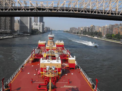
When I first started working on tugs we had a regular run up to Albany and Rensselaer, with stops in Poughkeepsie, Newburg, Peekskill, Tarrytown, and a half dozen little holes in the wall like Kingston’s Roundout Creek and further up in Athens.  I learned my way up and down the river by sitting for hours on end watching listening and learning from the Old Man, he just so happened to be my father.  An education like this, you can’t buy.

Those who seek to ply this waterway must prove their skill and local knowledge before they are qualified to make a transit.  Piloting the river takes practice and a multitude of trips to get a clear working knowledge of the bends and turns and shallows along the way.  It takes a good long while before any mate gets to stand the “upper end watch” without an experienced eye pointing the way and teaching him what he needs to know, but more about that later.

Fact; All foreign flag vessels carry a pilot that boards in Yonkers and directs the transit to the Port of Albany.  The reverse is also true, from Albany to Yonkers.  The bulk of commerce though (you may have guessed it), is tugboats and barges.  I’d like to add, if you don’t have recency on the river, you take/hire someone who does.

Like any waterway there are anchorages, designated areas to stop and wait for traffic, berths, or just rest.  The anchorages for deep draft vessels are extremely limited and get crowded rather quickly if weather turns ugly or backups at the port of Albany deny berthing for a spell.  The widest and deepest ones being south of Kingston, N.Y.


NOT A FACT; These new anchorages will be used for fleets of barges storing oil long term waiting for the price to improve;

The new proposed anchorages are not going to be long term storage for crude.  The new anchorages are not wide enough nor are they fit to accommodate the scale of storage to be a moneymaker.  The concept of storing oil in ships is not new, and yes it happens but not on the scale these anchorages could accommodate.  The ships that are utilized for this kind of storage are in the 2 million barrel range, they anchor offshore in very deep water with lots of room.  The practice is referred to as “contango”, and it’s costly.  Look it up.

The efforts of the River Keeper’s site and others like it denouncing any accommodation and the USCG’s comment section reflect a dearth of industry knowledge from regular folks fearing the worst without knowing the facts.

Citing the dangers of pollution (noise, light, and cargo) and resisting more anchorages is indeed disingenuous when those anchorages are being proposed to make it safer for vessels to run the river and stop when necessary.  It seems to me that trains running up and down each side of the river many times a day, contribute more noise and exhaust to the general population than what a few aeries of wealth must endure as we pass along the banks of the river.  But I digress.

The marine trade is the easy target, we’re noisy smelly boats that scar the vistas and cast a specter of foreboding on the pristine Hudson Valley.  Except for the fact that the marine industry is the reason you can rely on finding gas stations, airports and fuel deliveries stocked for use by the general public.  It’s why Walmart has those items you seek at a bargain and why your produce shelves are filled with exotic things like bananas in winter.

The industry isn’t being recognized for its expertise and safety record, it’s being denigrated by those who find it a convenient scapegoat.  Attacking the trade on the river is easy, most of the benefits derived are invisible at first glance.

It is also unreasonable to expect the river to cease being a critical artery serving the Northeast market.

These anchorages have been represented as a threat and that they will be full of vessels scarring the bottom and putting the river at a greater risk.  Again, anchorages constantly being filled to capacity, especially some of these smaller ones, is unlikely except for an event involving safe haven needs in the case of a hurricane.  During hurricane Sandy, the ATB unit I work on was anchored off Port Ewen for the duration of the storm along with a couple of other units.  Should we have been forced to go to sea?

Fact, the risk of a spill is unacceptable;

We feel the same way.  And we’re under a lot of scrutiny to make sure it doesn’t happen.  The oil transporters are vetted to a degree that most people never imagined.  The responsibility for cleanup falls directly on the owners of the cargo.

Transporters working for oil charterers are subject to what’s known as ship inspection reporting (S.I.R.E.) .

A group known as O.C.I.M.F. created a checklist of inspection points that transporters must submit to that covers everything. See the form here.  Rather comprehensive I’d say.

NOT A FACT The boats are old and poorly maintained;

Yeah,no.

Every boat is subject to regular maintenance and scheduled dry dockings to ensure their seaworthiness and operational reliability.  Yes some of the tugs are over 25 years old, and their upkeep is a large part of their operating cost, second only to insurance coverage.  Engine hours (hours of use) are tracked and specific replacement regimens are required to keep the boat operating in top form and fuel efficiency.  Filters, bearings, seals all have a lifespan and are changed out based on their expected service life.  Maintenance is a constant.  A long awaited “inspection requirement” has finally been implemented.  It’s known as Subchapter “M”, follow this link to see what the rule has set in place.

The rule that all vessels carrying petroleum must be double hulled was dictated by OPA 90, legislation directly following the Exxon Valdez grounding and spill in Prince William Sound in 1989.  Every barge moving oil on the inland waters of the United States is to be double hulled, every single one.  In the event of grounding the outer hull protects the inner hull and has proven its ability time and again to mitigate a cargo spill.

Rules for drug and alcohol testing, physicals, re-certification, formal radar training, all followed over the years.  Like so many safety regulations, they came on the heels of a major incident and investigation. The marine industry currently has more stringent training standards than most industries except for the airline industry.

Today’s mariner is safer, better equipped and more skilled than ever before.

Now for the bit about “recency” and what it means.

When someone operates in the same geographic area for a length of time, it becomes familiar.  The same way you know your way to and from work each day.  Whether you walk, drive, ride a train or take a bike you know the route “like the back of your hand”.

For transits on the river, tug mates train to know and remember each turn and landmark along the way.  They are keenly aware of tidal current and levels, the amount of water under the keel. They learn where to slow down to minimize bottom suction, bank suction, bank cushion and any number of physical effects the vessel might encounter.  And one of the most important things is where to stop if things get crazy.  If the visibility diminishes, if the wind is getting a little too strong, or if there is a mechanical issue that will impede the boat’s ability to continue safely the primary answer to this is an anchorage.   And right now, adding more will promote safe navigation rather than make it more dangerous to the river’s ecology.

It has become customary to avoid night transits in the “upper end” for more than a few years now.  It was ushered in at first for winter transits with deep draft barges when ice would overrun and drag channel markers to hell and gone.  Anyone who has spent any time running the river in icy conditions knows this situation well.  This is another good reason to know the route like the “back of your hand”.

It is now policy for most of the big transporters.  Insurance underwriters and charterers had a lot to do with insisting on daylight-only becoming a year-round practice.  This is the primary reason Kingston sees vessels anchored up off Port Ewen.  Deep draft and darkness don’t mix these days.

My case for the anchorages;

Denying additional anchorages is tantamount to closing the shoulder on the thruway, it’s the same as denying an aircraft an emergency landing field.  And in fact makes things worse instead of better, forcing a vessel that is blinded by a weather event, or hobbled with a mechanical difficulty to continue its voyage is madness.

The frequent complaints I’m reading concern shale oil and the hazard it presents to the river.  The safety record of transits made  by commercial vessels on the river is unmatched by any other mode of surface transportation.

The vessels carrying this product and many others, are manned by professionals with decades of experience moving cargo up and down the river in vessels with crews that have met the strictest vetting standards to date.  It’s too easy to lose sight of the fact that gasoline, jet fuel, heating oil, and household goods all move on the river.  Presently the shale oil market is slow, but the thirst for heating oil and gasoline, and jet fuel continues unabated.   If the Riverkeepers and their supporters are really serious about safety I recommend learning more about the industry you seek to encumber and try talking to us rather than promoting  a stance based on limited knowledge.

The new proposed anchorages are necessary avoid a catastrophe, not create one.  The industry issues regarding trade and global markets are not my concern here.  I am concerned with offering some background and information on how inaccurately my job and expertise is being portrayed.

As far as the USCG is concerned they will render a decision based in some part on the comments received and the safety of vessels moving cargo on the river.  I’m happy to see the comment period has been extended.  

I look forward to reading the final decisions and what the Coast Guard will decide.  You can be sure everyone isn’t going to be happy, but in my experience the decisions are well reasoned and consider all valid concerns.


Read Full Post »

https://gcaptain.com/kayakers-collide-new-york-ferry/

I would like to offer my condolences on both sides of this incident, no one wants to see this happen.

I have commented on this in the past discussing the lack of communication between recreational vessels and kayaks specifically.

https://captbbrucato.wordpress.com/2011/07/05/really-kayaks/

https://captbbrucato.wordpress.com/2011/07/06/kayaks-redux/

I’ve had an ongoing discussion in my comment section as a result of my post regarding the same.  Let’s take a moment to clear up a few things I’m seeing in the comment sections of the many posts floating around trying to assess blame, cause, and right of way.

The rules are specific and if followed, the thinking is (theoretically) that a collision should never occur.  Real world, not so much.


Rule 9 – Narrow Channels Return to the top of the page

(a) (i) A vessel proceeding along the course of a narrow channel or fairway shall keep as near to the outer limit of the channel or fairway which lies on her starboard side as is safe and practicable.

International Inland
(ii) Notwithstanding Rule 9(a)(i) and Rule 14(a), a power-driven vessel operating in narrow channel or fairway on the Great LakesWestern Rivers, or waters specified by the Secretary, and proceeding downbound with a following current shall have theright-of-way over an upbound vessel, shall propose the manner and place of passage, and shall initiate the maneuvering signals prescribed by Rule 34(a)(i), as appropriate. The vessel proceeding upbound against the current shall hold as necessary to permit safe passing.

(b) A vessel of less than 20 meters in length or a sailing vessel shall not impede the passage of a vessel [ which | that ] can safely navigate only within a narrow channel or fairway.

(c) A vessel engaged in fishing shall not impede the passage of any other vessel navigating within a narrow channel or fairway.

(d) A vessel [ shall | must ] not cross a narrow channel or fairway if such crossing impedes the passage of a vessel which can safely navigate only within that channel or fairway. The latter vessel [ may | must ] use the signal prescribed in Rule 34(d) if in doubt as to the intention of the crossing vessel.

(e)

(i)  In a narrow channel or fairway when overtaking [can take place only if the vessel to be overtaken has to take action to permit safe passing, the vessel intending to overtake |  the, power-driven vessel intending to overtake another power-driven vessel] shall indicate her intention by sounding the appropriate signal prescribed in [Rule 34(c)(i) | Rule 34(c)] [and take steps to permit safe passing]. The [power-driven] vessel [to be |being] overtaken, if in agreement, [shall] sound the [appropriate | same] signal [prescribed inRule 34(c)(ii)] and [may, if specifically agreed to,] take steps to permit safe passing. If in doubt she [may | shall] sound the signals prescribed in Rule 34(d).

(ii) This rule does not relieve the overtaking vessel of her obligation under Rule 13.

(f) A vessel nearing a bend or an area of a narrow channel or fairway where other vessels may be obscured by an intervening obstruction shall navigate with particular alertness and caution and shall sound the appropriate signal prescribed in Rule 34(e).

(g) Any vessel shall, if the circumstances of the case admit, avoid anchoring in a narrow channel.

My view, find the kayaks.  Get it?

5 31 10 bbrucato  DSCF0174r

And here is an example of what the prospective traffic can be..

It has been cited that rule 9c applies, in this case it does not.

It has been claimed this was a narrow channel, it is not.

It has been stated the “rule of tonnage” should have applied.  There is no such rule.  It is a construct of common sense similar to “let the big boat go first”, it is not a rule, reg, or statute.  It is a common sense admonition for small craft surviving encounters with large vessels in close quarters.

So far as I know, what has been reported is that the ferry was leaving his berth and turned into the sun for his westbound crossing and met with a flotilla of kayaks that were following the pier-heads close in.  Was there any communication from the kayaks? So far, unknown.  Did the ferry sound signals properly? Too early in the investigation and no one has said that he didn’t.  Were the kayaks being led by a club or organization?  Was there notice given to VTSNY (USCG Vessel Traffic Service)?  All this and more will come out in due course.  It is cold comfort that no one died, I take no pleasure in my prediction that this was a matter of “when ” as opposed to “if” it might happen.

For those of you who follow this blog, I ask that we all make an effort to educate those recreational boaters of their need to understand the dynamics of sharing the waterways in a safe manner and comply with the rules.

I see quite a few professionals misquoting the rules as well, this is not acceptable.

As professionals we are held to the higher standard and will suffer as well as impose suffering on others for our ignorance.  The hearing will not be pretty when it becomes apparent that our industry isn’t upholding the standard that sets us apart.

We must do better.

http://www.navcen.uscg.gov/?pageName=navRulesContent

Read and understand the “Rules”


, it’s clear there is a need to post this again.

Read Full Post »

sha1406032813sha1406033434sha1406033401I’ve been working in the G.O.M. for the last 16 months or so and regularly find myself making that long transit from the Dry Tortugas to the Southwest Pass of the Mississippi River.  The trip is more or less a great circle extending 400+ nm.  The first few times I made the crossing I noted that I would have an extreme “crab angle” due to the influence of the current known simply as “The Loop” aka a parent source of the Gulf Stream.  Sometimes I’d be steering upwards of IMAG162815 degrees into the current in order to make good my charted course and struggling to make any real speed.  Sliding across the Gulf is the rule.

There’s little doubt that this is old news to the guys who have been working the gulf for years, but it was a real surprise to me.  I mean, I expected different, but not to this degree.  Banging up against the Gulf Stream makes for slow going, no real mystery there.  And running with the stream is amazing in that your speed exceeds anything you thought the boat could do…but the loop?

The “Loop” is a current in the Gulf  of Mexico and flows at greater or lesser velocities as the seasons change.  It is known to meander widely and is formidable enough to knock more than 3 to 4 knots off your speed.  Meander is a gentle way of putting it, one watch you’re cruising nicely, next you’re wondering if the wheels fell off…  It’s seems to be all over the place, but with satellite imagery and telemetric magic it can be tracked.  And if it can be tracked it can be planned for.  Soooo for  those of you who know all about this, need read no further unless you’d like to proof my work.  In which case I will gladly accept any additional clarifying data you’d wish to provide.

The information one needs in order to visualize and to take advantage of / or steer around this current  has been available, but the resource (available in the form of “pilot charts”) only gives a general overview of the current by the month.  Honestly, I didn’t find them all that helpful.

My colleague gave me this link that provides just the kind of data you can use.  The site is paid for by our tax dollars and in my opinion money well spent.

You’ll need to make certain your security settings in your browser allow java applets to run.

The initial page gives you the overview which you can select a geographic area and what you’d like to see.  If you just want velocities, click it.  If you want to save the data as an image, select .gif format.  The smaller the geographic area, the easier you’ll be able to interpolate the lat and lon grid.  (I use MS Paint to overlay the more detailed lat/lon grid, it’s a bit tedious but yields an reasonably accurate grid to pick off waypoints)).

Note the red grid over the gulf.  you can resize it as you wish and pick the day average as well.  I usually use a 3 day average.  Once you’ve made your selection choose .gif if you want to save the image.  After that, you can eyeball the route you want to take and then identify the waypoints you’ll need to hit to go around the adverse current or to take advantage of a following current.


gom site

This link has been updated.

This will assist in selecting a course around the higher velocities and hopefully save some time on your next transit.  Sometimes a few miles out of the way can save more than a few hours, an all important option when it’s close to crew change.  After all that is the most important consideration….just sayin’

Read Full Post »

I found myself going through the “library” aboard and rediscovered an article written earlier this year for Marinelink regarding a “quandary” for AT/B’s, as the phrase was coined.  I thought it was just so much bullshit when I first read it and I had to every intention to comment.  The comment piece fell by the wayside for a while but I’ve renewed my interest so here goes.

It’s clear to me the term “quandary” was meant to generate a response from the industry and perhaps create a bit of drama.  And even though it has taken me until now to comment, I’d like to add my view and I offer my opinion as Master of one of the aforementioned “quandaries”..

Captain Jeff Cowan, (whose experience regarding AT/B’s remains in question for me) pontificates on the ill-conceived and imminently dangerous existence of AT/B’s in place of ships in the Jones Act trade.  He has drawn parallels that make a “sour grapes” spin sound complimentary.

I read with a good deal of glee the direct and articulate (see what I did there?) response from Mr Bob Hill of Ocean Tug and Barge, and thank Marinelink for publishing Mr Hill’s comments in their entirety.

I believe with all due respect, that Captain Cowan has missed the boat on this one (pun intended).  I have been working on one of Mr. Hill’s AT/B’s since 2003 (see the page header).  We were in the New England trade for many years and this last spring joined our sister unit the AT/B Christian F. Reinauer in the Gulf of Mexico to trade between Louisiana and Florida.  I have no illusions of what these units can and cannot do.

So let me address Captain Cowan’s assertions here;

My boat normally carries a 7 man crew, we have room for 10.

As far as STCW requirements; we are all STCW certified since the charterer requires it.  And yes Cap, we operate more than 200 miles offshore.  It’s a nearly 420 nm long trip from SW Pass to the Dry Tortugas on a great circle route, twice as long if you try to stay within twenty miles of the coast.  The inshore route is held as an option, though rarely used.

We moor with 8 lines, more if necessary.  A two man deck crew generally has it done in 15-20 minutes.  There isn’t any port/facility we call on that requires more than eight mooring lines.  I have witnessed one of the large Crowley 750 class moor and they take an hour or so with a dozen or more lines.  I can’t state with any certainty that’s the norm or the exception.

My company has had a Safety Management System in place since the late 90’s

We are S.Q.E. rated through the ISM Code and ISO 9001 and have been since 2004

We have 3 service gen-sets and one emergency gen-set all 99Kw, whaddaya think this is?

Since we’re talking Jones Act Shipping we’re not dealing with ISPS

Yes I will acknowledge the crew size could be larger.  The requirement for a greater number of people on board will have to be mandated by the charterers since the USCG and US Congress are unable or unwilling to force the issue.

I don’t have any illusions as to why this issue garners the attention it does from the “upper level license” community.  The Jones Act tanker trade is being somewhat eclipsed by AT/B’s, but not completely.  So let’s just settle down..

Since my AT/B unit was assigned work in the Gulf of Mexico I’m seeing a lot of AT/B’s working in the Gulf and I do mean a lot.   I’m seeing state-of-the-art rigs trading in Tampa, Jacksonville Florida, New Orleans and Port Everglades.  Bouchard (conversions), Reinauer (design-built and converted units), new Crowley designs, and OSG behemoths all taking bigger bites of the coastal trade away from tankers in the 350+ bbl range.  Crowley just completed building 17 new AT/B’s at a total cost of $1 billion USD, that ain’t small change.  AT/B’s are and will continue to be the future, but the tanker won’t be disappearing any time soon.

It’s true that for the most part we burn less fuel, we have fewer crew members (something we didn’t have a big say in), and yet we’re getting charters from the big guys on a regular basis. (As a point of order here; the majors don’t put their eggs in risky basket if you catch my drift.)

That’s not to say we’re not getting tons of rules; in addition to the rules quoted by Mr. Hill being satisfied to just build an AT/B, we’re tasked with tons of procedural and operational (ahem) guidance from our charterers.

We’re being inundated with terms we were more or less oblivious to a decade ago.  SOLAS, ISGOTT, OCIMF, SIRE, ISM, SMS, all these acronyms are in our daily lexicon and we’re subject to the same standards as ships in many cases.

A Cat 1 SIRE (similar to a full blown colonoscopy) is an audit that is generally reserved for ships, my rig has had more than a few of them so far.  We’ve tried to explain to the auditors that we’re not a ship with precious little success.

Here’s a Sample SIRE Report, how’s that for a fun-filled afternoon?

Captain Cowan cites the delays associated with tug and barge operations and the added time and costs that come with it, again I call b*llsh*t.  We are chartered with a clear statement of expected speed we’ll average and delivery times we’ll make.  The customer is well aware of what they are buying, if it was unacceptable we wouldn’t be so busy.

We don’t sail into storm systems, the customer wants all his cargo, not just most of it. We take a beating like everyone else if we get caught but we’d rather not.  Everyone knows it comes with the territory.  Ask anyone who has sailed through a hurricane and I’m damn near certain they’ll tell you to a man they’d rather not do it again.

The Scandia/North Cape was a single skin barge lost in a storm nobody should have sailed into.

The Valdez (with a crew of 24 plus) was not a total cargo loss, a large volume of her cargo spilled in Prince William Sound, but certainly not all of it….everyone seems to think the ship went away after the grounding.  It kinda did, the ship was towed to California, repaired, renamed and placed in service again with a different name.

Do we need to mention the Costa Concordia?

Those of us who are running these rigs are not breaking any rules, we’re doing our jobs.  And we’re doing it with “lower level licenses” in many cases.  Now I’m not particularly fond of the term but I can accept that there has to be a distinction.

Tankers run aground and spill cargo just like barges.  A detail frequently overlooked in this kind of argument is that a total loss means everything ended up in the water (and it’s a rare occurrence), let’s coin the phrase correctly shall we?  Double bottom technology isn’t perfect, but it’s helping prevent bad things from becoming disastrous.

With the number of disasters in the news these days concerning ships breaking in half, catching fire, sinking, colliding, and grounding; there aren’t many stories where I see someone claiming how much safer ships are.   The fact is that any vessel that puts to sea must assume risk.  Weather, training limitations and sometimes dumb luck are involved to make or break a journey.  We like to believe dumb luck has little influence on the outcome but anyone who has piloted their way unscathed out of a zero-dark thirty fog-bank in heavy traffic knows better.

I doubt that the ship drivers are worried at all, it’s the writers of blogs and magazine articles needing something to write about.  Nothing like creating a tempest in a teapot for a little entertainment.

If we’re going to discuss things in a constructive manner let’s agree that there’s little room for half truths.  After all this isn’t Fox News is it?

Read Full Post »

My last piece was generated from a rant I expressed in my pilothouse on my last trip down the East River heading for an anchorage in New York’s Bay Ridge Anchorage 21B.  Generally, my postings originate as rants that are rendered raw and then tempered with a good bit of editing for language and content.  I don’t just go off and shoot from the lip. Usually.

Of course, my professional perspective is what I draw on and my opinion is given full sway, it’s my blog after all.  But since my last post I’ve had some feedback that puts a neat spin on the ultimate aim of the article.  Education, for me as well as others.

A rather brave young woman decided to upbraid me for what she believed were insults to the Kayaking Community.  She was right on the money on some points and I give credit where it’s due.  She provided a couple of links I had not previously seen and found them to be really thoughtful and comprehensive in their advice on mixing recreational traffic with commercial vessels here in New York.

So in the interest of passing along the lesson of “you’re never too old to learn”, I wanted to recognize these organizations for working to make everyone safer in the pursuit of their particular vision of happiness.

The first one I’d like to share is one that includes enough information to rate as a must read for any recreational boater seeking to play on the waters of New York Harbor, or any busy waterway for that matter.

I Boat NY Harbor  The content of this site warms this lil’ old  tugboatman’s heart.  It’s comprehensive, articulate and clear and I ‘m glad someone has thought to do such a thorough job.  Kudos.

Safe Harbor.US Listing educational videos and notices of the events taking place in the harbor and good concise articles relating to interacting and avoiding close encounters with the behemoths that ply the waters of N.Y. Harbor.  The video catalog alone is worth a click.

I think it bears mentioning that the State of New York doesn’t recognize paddled craft as “vessels” subject to the rules as we understand them, that’s a big WTF as far as I’m concerned. This story just boggles the mind.

Everyone on the water has to have an understanding as to their responsibility when they take to the water for any reason.

And for now I’ll close with a thank you for the comments I’ve received.  Be safe.

Read Full Post »

photo by J. Milton

Who’s the mental midgit that came up with the idea of kayak tours of the East River’s waterfront?  There’s a growing trend of flotillas of multi-colored kayaks and canoes in all the wrong places in the recent past.  Not long ago I read an article somewhere extolling the beauty of the New York skyline from a kayak and all I could think was, “Hey Jackass, that’s what the Circle Line boats are for”.  Kayaks aren’t meant for a commercial waterway.

A quick Google search reveals quite a few sites for kayaking in the New York City area.  I visited a few of these sites and saw little in the way of educating kayakers to the danger of playing in the midst of commercial traffic, although to their credit they do keep novices quarantined in protected coves or basins to start. These stalwart if misguided souls that venture into open water relate how awestruck they are by the experience of New York Harbor kayaking, but I don’t think they’ve given serious thought to the environment they’ve entered.  We’re just a quaint backdrop to their vistas. Awestruck is what they will be when they’re caught in a back eddy off Hallet’s Point and I come around the corner in a full slide…but I don’t think the word can begin to describe the feeling they’ll have.

The sites I visited expressed no caveats or understanding of  how dangerous we are to them.  Yeah I get that the waterways are public, but do you really think that a ship is going to be able to wait for your pals to catch up to the group?

With kayaks paddling along in the East River, jet skis blasting by with more than two riders, water skiing on the sea plane approaches off 23rd St on the East River, NY., fishing in the channel, chasing tugboat wakes on jet skis, it’s going to get real ugly.  It all adds up to a situation where recreational boaters end up in the midst of heavy commercial traffic and they just don’t get it.

So here it is, the 4th of July weekend and I’m watching kayaks paddling up the East River off the Brooklyn piers and along the ferry slips of Lower Manhattan as I make my way to Bay Ridge Anchorage.  I mean really, kayaking on the East River!  C’mon already, you’re so low to the water that you’re barely visible to traffic at half a mile.  With no less than a dozen ferries and tows tossing wakes and flying by at a fair clip a disaster is only a matter of time.  God help you when you’ve finally figured out why you made such good time up the river only to find yourself paddling you ass off against the current to get back to your expensive SUV before dark.  Are you having fun now?

Every day during the recreational season boaters submit themselves to potentially fatal exposures and are completely oblivious to it. Thousands of pleasure seekers take to the water and expect their days to be just like the catalog pictures they perused before they bought their boat. Carefree and sunny days afloat without a care in the world, just bring enough sunscreen, granola bars and water.  No concern for proper radio etiquette or the correct channel to call for a radio check…jeez if they even have a radio.  Hell, most don’t understand a GPS unit enough to relay their position when they do get in trouble.  Kayaks? They may have a flashlight or even a small strobe, riiiight….another bouncing glittering light lost in the city’s skyline.

There’s an urgent need to educate the recreational boater and identify the issues that commercial traffic faces in everyday operations and that information should be spread far and wide with notices of “no-play-zones” enforced to minimize the dangers the recreational community is up against by being on the water along with the commercial community.

I submit that these enterprises should at least make an effort to have their presence announced or perhaps provide some sort of radio equipped motor escort on their little jaunts.  At least there would be someone to talk to.

For the life of me, I can’t seem to wrap my head around this kind of nonsense of playing in a commercial waterway, you might as well be playing hopscotch in the truck lanes on the New Jersey Turnpike.

Here’s an offer, if you or your friends are part of this madness, drop me a line.  I’d be willing to address the issue of education with your group (for carfare and lunch, gratuities will be accepted).  You’ll be safer for it and so will I.

Read Full Post »

Older Posts »