Feeds:
Posts
Comments

The final rule for the Radar Endorsement will be published in the Federal Register June 7th 2019.  Thus relieving actively employed licensed mariners from the 5 year renewal expense, time burden, and madness of it all.  This recertification was irrelevant long ago, those of us who remain active in the industry haven’t laid a grease pencil to screen or completed a plot on paper other than the renewal classes for a very long time.

That said, I quote a friend; “I so wish they would require a radar course that teaches practical skill for navigation and collision avoidance.” Capt. Doug Pine

Amen to that.

Attached find the final rule in .pdf format and a link to the Federal Register for reference.

Read it.  The final rule is effective as of July 22nd, 2019

The change do❤es not affect those seeking original licenses.

https://www.federalregister.gov/documents/2019/06/07/2019-11905/amendments-to-the-marine-radar-observer-refresher-training-regulations

2019-11905

20160818_052957On our last trip down the Hudson it happened that my Chief Mate received an inquiry via VHF as to whether I had shuffled off this mortal coil.  My lack of content seemed to indicate that I was no more…

Apparently in order to remain alive in cyberspace, one must frequently add content.  Who knew?

Generally I don’t post anything unless I have an issue that has either;

A. Pissed me off.

B. Is of immediate relevance to marine interests or concerns, safety wise.

C. Concerns a regulatory comment period or update,

And finally,

D. Something has really pissed me off.

So, in the interest of “the reports of my death have been greatly exaggerated”, I will offer some lovely seasonal and scenic shots I’ve taken in the last few months.  I hope you enjoy them.

P. S. Since I first began posting videos many technological improvements have come to fruition.  Drones with hd cameras have outclassed my humble offerings.  I gladly pass the baton to these new and inventive videographers.


20170412_200343

20151022_063047

IMG_20170407_201719_061

IMG_20170409_101008_927

IMG_20170409_101044_464

EDIT; Thank you to Carolina Salguero of The Mary Whalen for the head’s up.  The comment period has been extended to December 6th, 2016, the link for comments here.  If you wish to comment, please do so in an effort to clarify the misconceptions of the opposition.  We as an industry need to inform and educate our neighbors and help them understand the facts, and not embrace the hyperbole.

The Hudson River is a beautiful stretch of water.  It reaches from the Battery to Troy Locks in a roughly 130 mile meander that is wide at her lower reaches and narrow and dark in the ”upper end”.  The bridges that cross at various points offer vistas that will take your breath away.  The fact that this river has been a conduit for commerce for a few hundred years should come as no surprise.  It’s the perfect corridor, with limitations.

This post is in reference to the proposal for expanding the availability of anchorages along the river, including my effort to enlighten the less than well informed resistance the proposal has met. I will make an effort to mitigate the criticisms that were based on a lack of facts.  It’s clear to me and many of my colleagues that the resistance came with a flood of ignorance and supposition.  Those who are screaming the loudest are using arguments that clearly demonstrate how little they understand the marine industry, basic safety requirements, and the necessity of these refuges.

NIMBY at its worst.

So in an effort to fill in some blanks and erase some misconceptions I would offer this post as a start.  This is by no means a comprehensive list of concerns, but I sense these are the primary discussions.

As it has in the past, today’s waterborne commerce moves all manner of cargo to and from the ports of call along her banks.  The old brick works, mills, scrap yards, boat landings, and wharves are evidence of commerce past.  Today, this tradition continues on a much larger scale.

In case you didn’t already know;

When I first started working on tugs we had a regular run up to Albany and Rensselaer, with stops in Poughkeepsie, Newburg, Peekskill, Tarrytown, and a half dozen little holes in the wall like Kingston’s Roundout Creek and further up in Athens.  I learned my way up and down the river by sitting for hours on end watching listening and learning from the Old Man, he just so happened to be my father.  An education like this, you can’t buy.

Those who seek to ply this waterway must prove their skill and local knowledge before they are qualified to make a transit.  Piloting the river takes practice and a multitude of trips to get a clear working knowledge of the bends and turns and shallows along the way.  It takes a good long while before any mate gets to stand the “upper end watch” without an experienced eye pointing the way and teaching him what he needs to know, but more about that later.

Fact; All foreign flag vessels carry a pilot that boards in Yonkers and directs the transit to the Port of Albany.  The reverse is also true, from Albany to Yonkers.  The bulk of commerce though (you may have guessed it), is tugboats and barges.  I’d like to add, if you don’t have recency on the river, you take/hire someone who does.

Like any waterway there are anchorages, designated areas to stop and wait for traffic, berths, or just rest.  The anchorages for deep draft vessels are extremely limited and get crowded rather quickly if weather turns ugly or backups at the port of Albany deny berthing for a spell.  The widest and deepest ones being south of Kingston, N.Y.


NOT A FACT; These new anchorages will be used for fleets of barges storing oil long term waiting for the price to improve;

The new proposed anchorages are not going to be long term storage for crude.  The new anchorages are not wide enough nor are they fit to accommodate the scale of storage to be a moneymaker.  The concept of storing oil in ships is not new, and yes it happens but not on the scale these anchorages could accommodate.  The ships that are utilized for this kind of storage are in the 2 million barrel range, they anchor offshore in very deep water with lots of room.  The practice is referred to as “contango”, and it’s costly.  Look it up.

The efforts of the River Keeper’s site and others like it denouncing any accommodation and the USCG’s comment section reflect a dearth of industry knowledge from regular folks fearing the worst without knowing the facts.

Citing the dangers of pollution (noise, light, and cargo) and resisting more anchorages is indeed disingenuous when those anchorages are being proposed to make it safer for vessels to run the river and stop when necessary.  It seems to me that trains running up and down each side of the river many times a day, contribute more noise and exhaust to the general population than what a few aeries of wealth must endure as we pass along the banks of the river.  But I digress.

The marine trade is the easy target, we’re noisy smelly boats that scar the vistas and cast a specter of foreboding on the pristine Hudson Valley.  Except for the fact that the marine industry is the reason you can rely on finding gas stations, airports and fuel deliveries stocked for use by the general public.  It’s why Walmart has those items you seek at a bargain and why your produce shelves are filled with exotic things like bananas in winter.

The industry isn’t being recognized for its expertise and safety record, it’s being denigrated by those who find it a convenient scapegoat.  Attacking the trade on the river is easy, most of the benefits derived are invisible at first glance.

It is also unreasonable to expect the river to cease being a critical artery serving the Northeast market.

These anchorages have been represented as a threat and that they will be full of vessels scarring the bottom and putting the river at a greater risk.  Again, anchorages constantly being filled to capacity, especially some of these smaller ones, is unlikely except for an event involving safe haven needs in the case of a hurricane.  During hurricane Sandy, the ATB unit I work on was anchored off Port Ewen for the duration of the storm along with a couple of other units.  Should we have been forced to go to sea?

Fact, the risk of a spill is unacceptable;

We feel the same way.  And we’re under a lot of scrutiny to make sure it doesn’t happen.  The oil transporters are vetted to a degree that most people never imagined.  The responsibility for cleanup falls directly on the owners of the cargo.

Transporters working for oil charterers are subject to what’s known as ship inspection reporting (S.I.R.E.) .

A group known as O.C.I.M.F. created a checklist of inspection points that transporters must submit to that covers everything. See the form here.  Rather comprehensive I’d say.

NOT A FACT The boats are old and poorly maintained;

Yeah,no.

Every boat is subject to regular maintenance and scheduled dry dockings to ensure their seaworthiness and operational reliability.  Yes some of the tugs are over 25 years old, and their upkeep is a large part of their operating cost, second only to insurance coverage.  Engine hours (hours of use) are tracked and specific replacement regimens are required to keep the boat operating in top form and fuel efficiency.  Filters, bearings, seals all have a lifespan and are changed out based on their expected service life.  Maintenance is a constant.  A long awaited “inspection requirement” has finally been implemented.  It’s known as Subchapter “M”, follow this link to see what the rule has set in place.

The rule that all vessels carrying petroleum must be double hulled was dictated by OPA 90, legislation directly following the Exxon Valdez grounding and spill in Prince William Sound in 1989.  Every barge moving oil on the inland waters of the United States is to be double hulled, every single one.  In the event of grounding the outer hull protects the inner hull and has proven its ability time and again to mitigate a cargo spill.

Rules for drug and alcohol testing, physicals, re-certification, formal radar training, all followed over the years.  Like so many safety regulations, they came on the heels of a major incident and investigation. The marine industry currently has more stringent training standards than most industries except for the airline industry.

Today’s mariner is safer, better equipped and more skilled than ever before.

Now for the bit about “recency” and what it means.

When someone operates in the same geographic area for a length of time, it becomes familiar.  The same way you know your way to and from work each day.  Whether you walk, drive, ride a train or take a bike you know the route “like the back of your hand”.

For transits on the river, tug mates train to know and remember each turn and landmark along the way.  They are keenly aware of tidal current and levels, the amount of water under the keel. They learn where to slow down to minimize bottom suction, bank suction, bank cushion and any number of physical effects the vessel might encounter.  And one of the most important things is where to stop if things get crazy.  If the visibility diminishes, if the wind is getting a little too strong, or if there is a mechanical issue that will impede the boat’s ability to continue safely the primary answer to this is an anchorage.   And right now, adding more will promote safe navigation rather than make it more dangerous to the river’s ecology.

It has become customary to avoid night transits in the “upper end” for more than a few years now.  It was ushered in at first for winter transits with deep draft barges when ice would overrun and drag channel markers to hell and gone.  Anyone who has spent any time running the river in icy conditions knows this situation well.  This is another good reason to know the route like the “back of your hand”.

It is now policy for most of the big transporters.  Insurance underwriters and charterers had a lot to do with insisting on daylight-only becoming a year-round practice.  This is the primary reason Kingston sees vessels anchored up off Port Ewen.  Deep draft and darkness don’t mix these days.

My case for the anchorages;

Denying additional anchorages is tantamount to closing the shoulder on the thruway, it’s the same as denying an aircraft an emergency landing field.  And in fact makes things worse instead of better, forcing a vessel that is blinded by a weather event, or hobbled with a mechanical difficulty to continue its voyage is madness.

The frequent complaints I’m reading concern shale oil and the hazard it presents to the river.  The safety record of transits made  by commercial vessels on the river is unmatched by any other mode of surface transportation.

The vessels carrying this product and many others, are manned by professionals with decades of experience moving cargo up and down the river in vessels with crews that have met the strictest vetting standards to date.  It’s too easy to lose sight of the fact that gasoline, jet fuel, heating oil, and household goods all move on the river.  Presently the shale oil market is slow, but the thirst for heating oil and gasoline, and jet fuel continues unabated.   If the Riverkeepers and their supporters are really serious about safety I recommend learning more about the industry you seek to encumber and try talking to us rather than promoting  a stance based on limited knowledge.

The new proposed anchorages are necessary avoid a catastrophe, not create one.  The industry issues regarding trade and global markets are not my concern here.  I am concerned with offering some background and information on how inaccurately my job and expertise is being portrayed.

As far as the USCG is concerned they will render a decision based in some part on the comments received and the safety of vessels moving cargo on the river.  I’m happy to see the comment period has been extended.  

I look forward to reading the final decisions and what the Coast Guard will decide.  You can be sure everyone isn’t going to be happy, but in my experience the decisions are well reasoned and consider all valid concerns.


So it happened….

https://gcaptain.com/kayakers-collide-new-york-ferry/

I would like to offer my condolences on both sides of this incident, no one wants to see this happen.

I have commented on this in the past discussing the lack of communication between recreational vessels and kayaks specifically.

https://captbbrucato.wordpress.com/2011/07/05/really-kayaks/

https://captbbrucato.wordpress.com/2011/07/06/kayaks-redux/

I’ve had an ongoing discussion in my comment section as a result of my post regarding the same.  Let’s take a moment to clear up a few things I’m seeing in the comment sections of the many posts floating around trying to assess blame, cause, and right of way.

The rules are specific and if followed, the thinking is (theoretically) that a collision should never occur.  Real world, not so much.


Rule 9 – Narrow Channels Return to the top of the page

(a) (i) A vessel proceeding along the course of a narrow channel or fairway shall keep as near to the outer limit of the channel or fairway which lies on her starboard side as is safe and practicable.

International Inland
(ii) Notwithstanding Rule 9(a)(i) and Rule 14(a), a power-driven vessel operating in narrow channel or fairway on the Great LakesWestern Rivers, or waters specified by the Secretary, and proceeding downbound with a following current shall have theright-of-way over an upbound vessel, shall propose the manner and place of passage, and shall initiate the maneuvering signals prescribed by Rule 34(a)(i), as appropriate. The vessel proceeding upbound against the current shall hold as necessary to permit safe passing.

(b) A vessel of less than 20 meters in length or a sailing vessel shall not impede the passage of a vessel [ which | that ] can safely navigate only within a narrow channel or fairway.

(c) A vessel engaged in fishing shall not impede the passage of any other vessel navigating within a narrow channel or fairway.

(d) A vessel [ shall | must ] not cross a narrow channel or fairway if such crossing impedes the passage of a vessel which can safely navigate only within that channel or fairway. The latter vessel [ may | must ] use the signal prescribed in Rule 34(d) if in doubt as to the intention of the crossing vessel.

(e)

(i)  In a narrow channel or fairway when overtaking [can take place only if the vessel to be overtaken has to take action to permit safe passing, the vessel intending to overtake |  the, power-driven vessel intending to overtake another power-driven vessel] shall indicate her intention by sounding the appropriate signal prescribed in [Rule 34(c)(i) | Rule 34(c)] [and take steps to permit safe passing]. The [power-driven] vessel [to be |being] overtaken, if in agreement, [shall] sound the [appropriate | same] signal [prescribed inRule 34(c)(ii)] and [may, if specifically agreed to,] take steps to permit safe passing. If in doubt she [may | shall] sound the signals prescribed in Rule 34(d).

(ii) This rule does not relieve the overtaking vessel of her obligation under Rule 13.

(f) A vessel nearing a bend or an area of a narrow channel or fairway where other vessels may be obscured by an intervening obstruction shall navigate with particular alertness and caution and shall sound the appropriate signal prescribed in Rule 34(e).

(g) Any vessel shall, if the circumstances of the case admit, avoid anchoring in a narrow channel.

My view, find the kayaks.  Get it?

5 31 10 bbrucato  DSCF0174r

And here is an example of what the prospective traffic can be..

It has been cited that rule 9c applies, in this case it does not.

It has been claimed this was a narrow channel, it is not.

It has been stated the “rule of tonnage” should have applied.  There is no such rule.  It is a construct of common sense similar to “let the big boat go first”, it is not a rule, reg, or statute.  It is a common sense admonition for small craft surviving encounters with large vessels in close quarters.

So far as I know, what has been reported is that the ferry was leaving his berth and turned into the sun for his westbound crossing and met with a flotilla of kayaks that were following the pier-heads close in.  Was there any communication from the kayaks? So far, unknown.  Did the ferry sound signals properly? Too early in the investigation and no one has said that he didn’t.  Were the kayaks being led by a club or organization?  Was there notice given to VTSNY (USCG Vessel Traffic Service)?  All this and more will come out in due course.  It is cold comfort that no one died, I take no pleasure in my prediction that this was a matter of “when ” as opposed to “if” it might happen.

For those of you who follow this blog, I ask that we all make an effort to educate those recreational boaters of their need to understand the dynamics of sharing the waterways in a safe manner and comply with the rules.

I see quite a few professionals misquoting the rules as well, this is not acceptable.

As professionals we are held to the higher standard and will suffer as well as impose suffering on others for our ignorance.  The hearing will not be pretty when it becomes apparent that our industry isn’t upholding the standard that sets us apart.

We must do better.

http://www.navcen.uscg.gov/?pageName=navRulesContent

Read and understand the “Rules”


, it’s clear there is a need to post this again.

Time for Some Photos

It’s been a while, here are some views from my office in no particular order.  bb

Back Home Again

The Nicole has been trading in the Gulf of Mexico for the last three years or so, it was a nice run.  Tropical, deep blue and vast.  We dodged a couple hurricanes in the last months and made the trip back from the warm southern climes a couple of hitches back.  It was an eight and a half day voyage from New Orleans that included riding the back of Hurricane Joaquin off the Carolinas for a bit.  It got a little nasty to say the least.

20151008_123252-1

Our operations are now focused in the Northeast market for the time being and it’s busier work.  A lot of boat handling and action on familiar waters.  I have to say I missed the bustle of New York.  The benefits of working in the gulf were balanced by the headache of air travel limitations and sometimes grueling gauntlets of connections.  Once on board, the work was a bit more sedate with long distances and vistas of open water.  I don’t miss the traveling, I’ve seen enough airports for a while.

So in the spirit of sharing, here are some photos I’ve taken of our return to the northeast.

2014-08-16 17.47.27

FYI, The Coast Pilot now includes this scan code to its download link for the latest and most up-to-date version for your e-files..

UPDATE by request:  In keeping this method up-to-date I’ve found that the Coast Pilots and Light Lists are available as totally updated pubs available for download monthly.  Now while most of us would love to maintain a purely electronic catalog I’d still recommend keeping the paper version (at least for the Coast Pilot) given the method for corrections described here is not as daunting as the old “confetti party” we were once forced to endure.  The chance that you wouldn’t have a computer screen with which to view the information is slim but it sure is easier (IMHO) to page through a book than a 600 page .pdf.

Captain Victor Antunez asked me to show what the end result looks like to clear up any confusion regarding my method.  In keeping with said request here is the correction for CP#3 as found in the latest NtM 34.

cp3

The next thing to do is turn to the indicated chapter and paragraph and make a note in the margin thus.  Complete all indicated corrections and then close the book, you’re done…….

20140816_203626

The method for the damned Light List is even simpler, download a completely corrected version every month..

The links in this post have been repaired.  I saw fit to re-post this so it can be of use.

I’m going to describe a couple of publication correction methods that I employ.  I believe these methods will save you and your Mates time when it comes to keeping things up to date and offer it up to those of you who wish to comment. First I should emphasize that this alternative method may or may not meet the needs of your situation.  Check with your Port Captain or Compliance Office to be certain that these  methods meet the intent of any company policy or vendor preference.  Here is a link for the Policy letter issued by the USCG allowing the use of electronic copies and archives of commonly carried nav-pubs.  You’ll need to have reliable internet access for this method to work well.

The NtM corrections to the US Coast Pilots and the Light Lists are the most tedious and time consuming chores the mate must accomplish in the course of his day-to-day duties.  I’ve always seen it as a huge effort for a frequently redundant and limited application/resource, resources that aren’t utilized enough in my day-to-day operations to require so much attention.

The traditional method for correcting the Coast Pilot has always been recognized as a poor solution for those of us not equipped with self-updating software and E.C.D.I.S. systems,

“Cut and Paste” is the name of the game and each Coast Pilot  becomes a confetti farm after only a few cycles of the Notice to Mariners weekly editions.

It always begins with a pile of freshly issued hard copies of the Notice to Mariners, a pair of scissors, two rolls of cellophane tape, a pot of coffee, and most of the afternoon watch to bring your catalog of Coast Pilots up to date.  As time goes by with each edition nearing the end of its service life, one windy day is all it takes to blow half of your corrections all over the pilothouse the moment you open the damn thing and all your work is literally “in the wind”.

Then as if that wasn’t enough, this was followed by a marathon session of correcting the many volumes of the Light List at hand using a perfectly medieval method involving perhaps a magnifying glass and the ability to print in miniature like a Gregorian monk rewriting Ted Kaczynski’s Unabomber manifesto.  It could quite possibly drive a man insane, especially after completing about 10,000 corrections  just in time to receive the next newest NtM with 10,000 more.

When you think about it, the corrections to the Light List are really a list of completed work orders for the gang working Aids to Navigation in the USCG.  Every time they move an aid, paint a buoy, or reset a range light it generates a correction.  I mean I do get it, but ladies and gentlemen, these folks are really busy.

First, how do we deal with this cut and paste thing?

The Coast Pilot corrections using this new method are easy.  The NtM has been available online for many years and anyone with a laptop and internet access can download and save a couple of years worth of NtM’s without taking up more than a gigabyte on their hard-drive.  This ability to archive the NtM is a huge improvement over the old method of keeping the butchered hard copies somewhere aboard to show they’ve been utilized.  With this method you’ll never need to print out Coast Pilot corrections.

Now that an archive has been created, the Coast Pilot can be updated using a ballpoint pen and about 25 minutes of your time.  Turning to the pages in the NtM that list the corrections to the CP, note the volume, edition and change number.

1. Open the Coast Pilot, enter the change number as always; Change#, NtM#, your initials, and the date the change is being entered.

2. Next find the page and paragraph of the correction listed in the NtM.

3. In the left margin of the cited paragraph, write the NtM # in ink and repeat this practice for every correction available for the CP.  For example, you’re using NtM 25/09, the note in the margin should read “25/09“, that’s it.  Also, remember that a NtM may contain numerous “change numbers”, be sure to enter these properly as you correct each CP.

4. Now close the book.

Since you’ve changed how you correct this book, you must change the method in which this book is used.  Now the archive you’ve created must be maintained for as long as the edition is valid.

If you find yourself referring to the CP for information and come across a notation you’ve made in the left margin you know to refer to the NtM archive and must seek out and read that particular NtM (25/09) for the applicable update for that specific paragraph.  As you’re doing that you’ll note a definite lack of confetti present, no matter the age of the book.

The Light List ( the list that never ends) is even easier.

The Light List does not lend itself to correction easily using the old Gregorian method.

It’s wickedly tedious , but the method to update this publication needn’t be so overwhelming.

The NtM is not the publication of choice for me for correcting the Light List. What ‘s that you say? Well, the USCG publishes a cumulative summary of corrections for each volume of the LL.  Basically, every correction for Volume 1 of the Light List is compiled into a regularly updated archive available for download and saving just like the NtM, but each archive is dedicated to its respective volume.  From the date the volume is published to the most recent NtM, each volume’s corrections are compiled as they appeared in each NtM.

So, I can go to the NavCen website and download all of Light List Volume 1 corrections and save it each month as I can for every volume of the Light List offered by the National Ocean Service and USCG.  The archive found on the update page always carries the same name for each volume number unlike the Ntm which necessarily increases (01/09 to 52-/09) as the weeks go by.  Volume 1’s summary will always be named V1D01.pdf.  When you download the newest archive it will prompt your browser to ask if you wish to overwrite the old file and of course you will select yes.  You now have the latest correction summary for Light List 1 since it was published.

1. At this point, you only need to make one mark in the Light List and that is to note the NtM# that your archive is current with in the record of change in the front of the book and after you’ve done that, you can close the book.

Now we dip our toes into the 21st century;

2. If you find yourself referring to the LL, the same method as always is used to identify any aid, by its LL#.  Once you locate the aid you want, (or the place where it should be listed), the original “date of publish” info is all you have.  How do you know the information is current if there aren’t any physical corrections in the book?

The summary of correction archive contains a copy of every Vol1 correction page printed in the NtM since the Vol. 1 publish date from low to high.  In the case of LL1, from 51/08 at the bottom of the list to 25/09 at the top.  It should be noted that there may be multiple corrections  for your query, check the entire summary for the aid in question.

3. Once the aid in question has been found in the LL, the archive is scanned from the bottom to the top of the list for the same LL#.

3a. If you don’t find the LL# for the aid your looking at, the book is the latest information available for that aid.

3b. If you do find the LL#in the archive, you’ll need to scan the entire summary for any other incidence of that number.  If you have found the LL# of your aid in the summary, that information will be the most current and correct.  You need to remember as well that new sub-sets may have added, so a scan above and below the specific aid’s LL# you’re referencing is in order.

So, instead of spending hours of your life writing corrections into this publication, you’ve spent five minutes scanning an archive to find what you need.

Take a look at this method, if you would like to discuss it further, drop me a line.

Light List Summary Links;

Volume 1 First District, Volume 2 Fifth District, Volume 3 Seventh District, Volume 4 Eighth District GOM, Volume 5 Eighth District WR, Volume 6 Eleventh DistrictVolume 7 Ninth District,

sha1406032813sha1406033434sha1406033401I’ve been working in the G.O.M. for the last 16 months or so and regularly find myself making that long transit from the Dry Tortugas to the Southwest Pass of the Mississippi River.  The trip is more or less a great circle extending 400+ nm.  The first few times I made the crossing I noted that I would have an extreme “crab angle” due to the influence of the current known simply as “The Loop” aka a parent source of the Gulf Stream.  Sometimes I’d be steering upwards of IMAG162815 degrees into the current in order to make good my charted course and struggling to make any real speed.  Sliding across the Gulf is the rule.

There’s little doubt that this is old news to the guys who have been working the gulf for years, but it was a real surprise to me.  I mean, I expected different, but not to this degree.  Banging up against the Gulf Stream makes for slow going, no real mystery there.  And running with the stream is amazing in that your speed exceeds anything you thought the boat could do…but the loop?

The “Loop” is a current in the Gulf  of Mexico and flows at greater or lesser velocities as the seasons change.  It is known to meander widely and is formidable enough to knock more than 3 to 4 knots off your speed.  Meander is a gentle way of putting it, one watch you’re cruising nicely, next you’re wondering if the wheels fell off…  It’s seems to be all over the place, but with satellite imagery and telemetric magic it can be tracked.  And if it can be tracked it can be planned for.  Soooo for  those of you who know all about this, need read no further unless you’d like to proof my work.  In which case I will gladly accept any additional clarifying data you’d wish to provide.

The information one needs in order to visualize and to take advantage of / or steer around this current  has been available, but the resource (available in the form of “pilot charts”) only gives a general overview of the current by the month.  Honestly, I didn’t find them all that helpful.

My colleague gave me this link that provides just the kind of data you can use.  The site is paid for by our tax dollars and in my opinion money well spent.

You’ll need to make certain your security settings in your browser allow java applets to run.

The initial page gives you the overview which you can select a geographic area and what you’d like to see.  If you just want velocities, click it.  If you want to save the data as an image, select .gif format.  The smaller the geographic area, the easier you’ll be able to interpolate the lat and lon grid.  (I use MS Paint to overlay the more detailed lat/lon grid, it’s a bit tedious but yields an reasonably accurate grid to pick off waypoints)).

Note the red grid over the gulf.  you can resize it as you wish and pick the day average as well.  I usually use a 3 day average.  Once you’ve made your selection choose .gif if you want to save the image.  After that, you can eyeball the route you want to take and then identify the waypoints you’ll need to hit to go around the adverse current or to take advantage of a following current.


gom site

This link has been updated.

This will assist in selecting a course around the higher velocities and hopefully save some time on your next transit.  Sometimes a few miles out of the way can save more than a few hours, an all important option when it’s close to crew change.  After all that is the most important consideration….just sayin’

As you may have read in previous posts I wanted to try the “online experience” for my radar renewal.  It did not go well.  I signed up paid $225.00 and received my study material and then proceeded to work myself back up to a passing proficiency for rapid radar plotting.  I took a couple of months, made an appointment at the nearest Prometric Testing center and believing I was ready, scheduled and sat for my renewal.   All went well up to this point.  The facility is clean, well organized and strict.  I arrived early and was processed quickly.

The exam was straightforward enough.  Once you get settled in at your exam station, the computer program is loaded and a timer promptly begins with your radar scenario.

There was the first part of roughly ten questions regarding theory and then the plots.  I had no difficulty with theory and scored 100%.

You get two shots at the plotting section.   It’s a normal three target screen, you need only identify the “most dangerous target” and proceed with your plot.  I must add the timer is a bit unnerving.  If you fail the first time it gives you the opportunity to select and proceed with a second chance/ different set of plots and you fly or fall at the end of the scenario.

I failed both my attempts on the exam and felt more than a bit embarrassed seeing as I had never not passed what we’ve all come to see as a less than useful skill since the advent of A.R.P.A. and modern radar systems.

I must admit that the failure was likely my fault due to my time management (or lack thereof) and perhaps a careless error.

The plots are “time sensitive” and you’re only allowed three minutes to solve for NTCPA and new course.  I overran the time limit first time out.  After the exam I noted in the instructions on this particular exam that there was no specific time for MX expressly indicated.  The instructions for MX or “time of execution” were included in the practice instructions but absent in the actual exam instructions.

This isn’t an excuse, since after the fact I  found the instructions in the practice material clearly indicated that the exam’s execution point was to be at 12 minutes.  I missed that somehow.

Okay, so I failed.  I was more than a bit upset, I have never failed this recert but I guess there’s a first time for everything.

No amount of post failure negotiation was sufficient to convince the proctors of the center to help, and the online school was adamant that in order to retest I’d have to pony up another $225.00 and reschedule.   I didn’t elect to take them up on it.

Instead I called SUNY Maritime and scheduled my one-day renewal at a “brick and mortar ” school.  I paid the fee ($325.00) and practiced the material they sent and showed up in the Bronx for the recert like I’ve done in the past.

The experience was easier in that I had an instructor on site that understood the material.  He could see which of us in class were comfortable and possessed the skill set and helped guide those who were a bit shaky during the morning practice session and boosted their confidence level.  That alone means a lot to anyone who’s uncomfortable in exam situations.

You’re not handed the cert,  it’s challenging and you earn it.  But that said, having the class in a place where it’s a familiar curricula helps.  Online courses are fine, but you’re strictly on your own at the center.  After you are scanned, frisked and asked to empty your pockets no one can or may assist you in any way.

I passed SUNY’s recert program as expected and left to deal with the gauntlet that is the NY area’s traffic to get home.

In closing, if you’re absolutely certain and speedy with rapid radar plotting you should give the online experience a go.  If you’re like me, go to a school where an instructor can kick you back inside the lines of competency and get you through this “every 5 year P.I.T.A.”.  I have a couple more times I have to submit to this ordeal and you can be sure it will be at a “brick and mortar” school from here on.

In keeping with the continuing U.S.C.G. compliance updates for the S.T.C.W. Convention you may now have your renewals “post-dated” and virtually eliminate what has been referred to as “license creep”.  Read this notice carefully as it only applies to renewals.

It’s one of the few really good things coming out of the convention.

STCW_publication_final_rule_24Dec13

Here’s a little light reading for those of us in the industry.  The final rule will bring US mariners (kicking and screaming) into compliance with the IMO convention.  More info to come once the NVICs start flying.  Expect confusion, anxiety and more training requirements.  The best way to survive this transition period (ending with full compliance expected in 2017) is to pay close attention to the next batch of NVICs.

Then, open your calendar and your wallet ’cause this is going to sting..

school_logo_100
I’m beginning my radar renewal process a bit early this time using the Calhoon MEBA Engineering School Distance Learning Program.
When I wrote the last article describing this new way to handle training and re-certification I said that I would be giving this a try as my renewal date approached.

I should say that my first attempt at finding and registering for the course was slightly side-tracked by the fact that I thought I would be using the Prometric portal.  Well let’s say that after a few calls to an endless loop of phone menu items and toll free calls including one to somewhere in southeast Asia, I found my way by calling  the Calhoon MEBA School directly and spoke to a nice young woman named Lisa Mc Neil.  (410-822-9600 ext 322).  I was able to ask all my questions and get answers from a real human being and I was set right in short order.

So here’s the deal as I understand it;

Any mariner can apply for their radar re-cert with this school, you do not have to be a member of MEBA.  Follow this link to their home page, hover your mouse over the “Online Courses” menu item and check out the drop-down menu.  Read everything then fill out your application, select your course and pay the lady.  You’ll receive an email with confirmation and then you’ll have to allow a day for processing the order.  You will receive an email confirming your registration and access to the study material and also (more importantly) your login and access to the instructors for any questions you might have (via email).

In the information link it states you have a month, but the conversation I had with Ms. McNeil made it clear that I could study longer if necessary and not have any problem.  Ms. McNeil can offer more info if you need more time.

Once you have registered and been accepted you will be given the key to the online course material and practice with it as often as you like.  The online course and testing material comes from the same source used at the Prometric Center on your exam day.
Clipboard01Okay so you’re ready to test.  The scheduling process is email based and finding the exam near your home becomes your next step.  Here’s where the Prometric System comes into play through the Calhoon website.  
Select “Locate a Test Center” and follow through the menu to filter it down by country, state, etc…

Select the course;

Clipboard01a

Search the nearest test center;

Clipboard01b

Select the center you want;

Clipboard01c

Check for available dates

Clipboard01d

Clipboard01e

So that’s what I’ve got so far.  I will report back after I’ve completed the process and let you know how it went.  So far I’m on track.

It’s been a few months and the weather conditions down here in the Gulf of Mexico continue to offer a diverse experience from one voyage to the next. Here’s what we had to deal with for a day and a half just before the Thanksgiving Holiday.  What you’re watching is what an ATB is designed to do, ride weather that would keep a conventional tug and barge hove to on a slow ahead engine or weather bound all together.   We don’t necessarily enjoy this kind of ride, but the fact the ATB tolerates this kind of weather and is still able to make a respectable amount of headway is testament to the effectiveness of the design.


The Nicole L. Reinauer heading for Tampa, Florida on a stormy day…. from Bill Brucato on Vimeo.

I found myself going through the “library” aboard and rediscovered an article written earlier this year for Marinelink regarding a “quandary” for AT/B’s, as the phrase was coined.  I thought it was just so much bullshit when I first read it and I had to every intention to comment.  The comment piece fell by the wayside for a while but I’ve renewed my interest so here goes.

It’s clear to me the term “quandary” was meant to generate a response from the industry and perhaps create a bit of drama.  And even though it has taken me until now to comment, I’d like to add my view and I offer my opinion as Master of one of the aforementioned “quandaries”..

Captain Jeff Cowan, (whose experience regarding AT/B’s remains in question for me) pontificates on the ill-conceived and imminently dangerous existence of AT/B’s in place of ships in the Jones Act trade.  He has drawn parallels that make a “sour grapes” spin sound complimentary.

I read with a good deal of glee the direct and articulate (see what I did there?) response from Mr Bob Hill of Ocean Tug and Barge, and thank Marinelink for publishing Mr Hill’s comments in their entirety.

I believe with all due respect, that Captain Cowan has missed the boat on this one (pun intended).  I have been working on one of Mr. Hill’s AT/B’s since 2003 (see the page header).  We were in the New England trade for many years and this last spring joined our sister unit the AT/B Christian F. Reinauer in the Gulf of Mexico to trade between Louisiana and Florida.  I have no illusions of what these units can and cannot do.

So let me address Captain Cowan’s assertions here;

My boat normally carries a 7 man crew, we have room for 10.

As far as STCW requirements; we are all STCW certified since the charterer requires it.  And yes Cap, we operate more than 200 miles offshore.  It’s a nearly 420 nm long trip from SW Pass to the Dry Tortugas on a great circle route, twice as long if you try to stay within twenty miles of the coast.  The inshore route is held as an option, though rarely used.

We moor with 8 lines, more if necessary.  A two man deck crew generally has it done in 15-20 minutes.  There isn’t any port/facility we call on that requires more than eight mooring lines.  I have witnessed one of the large Crowley 750 class moor and they take an hour or so with a dozen or more lines.  I can’t state with any certainty that’s the norm or the exception.

My company has had a Safety Management System in place since the late 90’s

We are S.Q.E. rated through the ISM Code and ISO 9001 and have been since 2004

We have 3 service gen-sets and one emergency gen-set all 99Kw, whaddaya think this is?

Since we’re talking Jones Act Shipping we’re not dealing with ISPS

Yes I will acknowledge the crew size could be larger.  The requirement for a greater number of people on board will have to be mandated by the charterers since the USCG and US Congress are unable or unwilling to force the issue.

I don’t have any illusions as to why this issue garners the attention it does from the “upper level license” community.  The Jones Act tanker trade is being somewhat eclipsed by AT/B’s, but not completely.  So let’s just settle down..

Since my AT/B unit was assigned work in the Gulf of Mexico I’m seeing a lot of AT/B’s working in the Gulf and I do mean a lot.   I’m seeing state-of-the-art rigs trading in Tampa, Jacksonville Florida, New Orleans and Port Everglades.  Bouchard (conversions), Reinauer (design-built and converted units), new Crowley designs, and OSG behemoths all taking bigger bites of the coastal trade away from tankers in the 350+ bbl range.  Crowley just completed building 17 new AT/B’s at a total cost of $1 billion USD, that ain’t small change.  AT/B’s are and will continue to be the future, but the tanker won’t be disappearing any time soon.

It’s true that for the most part we burn less fuel, we have fewer crew members (something we didn’t have a big say in), and yet we’re getting charters from the big guys on a regular basis. (As a point of order here; the majors don’t put their eggs in risky basket if you catch my drift.)

That’s not to say we’re not getting tons of rules; in addition to the rules quoted by Mr. Hill being satisfied to just build an AT/B, we’re tasked with tons of procedural and operational (ahem) guidance from our charterers.

We’re being inundated with terms we were more or less oblivious to a decade ago.  SOLAS, ISGOTT, OCIMF, SIRE, ISM, SMS, all these acronyms are in our daily lexicon and we’re subject to the same standards as ships in many cases.

A Cat 1 SIRE (similar to a full blown colonoscopy) is an audit that is generally reserved for ships, my rig has had more than a few of them so far.  We’ve tried to explain to the auditors that we’re not a ship with precious little success.

Here’s a Sample SIRE Report, how’s that for a fun-filled afternoon?

Captain Cowan cites the delays associated with tug and barge operations and the added time and costs that come with it, again I call b*llsh*t.  We are chartered with a clear statement of expected speed we’ll average and delivery times we’ll make.  The customer is well aware of what they are buying, if it was unacceptable we wouldn’t be so busy.

We don’t sail into storm systems, the customer wants all his cargo, not just most of it. We take a beating like everyone else if we get caught but we’d rather not.  Everyone knows it comes with the territory.  Ask anyone who has sailed through a hurricane and I’m damn near certain they’ll tell you to a man they’d rather not do it again.

The Scandia/North Cape was a single skin barge lost in a storm nobody should have sailed into.

The Valdez (with a crew of 24 plus) was not a total cargo loss, a large volume of her cargo spilled in Prince William Sound, but certainly not all of it….everyone seems to think the ship went away after the grounding.  It kinda did, the ship was towed to California, repaired, renamed and placed in service again with a different name.

Do we need to mention the Costa Concordia?

Those of us who are running these rigs are not breaking any rules, we’re doing our jobs.  And we’re doing it with “lower level licenses” in many cases.  Now I’m not particularly fond of the term but I can accept that there has to be a distinction.

Tankers run aground and spill cargo just like barges.  A detail frequently overlooked in this kind of argument is that a total loss means everything ended up in the water (and it’s a rare occurrence), let’s coin the phrase correctly shall we?  Double bottom technology isn’t perfect, but it’s helping prevent bad things from becoming disastrous.

With the number of disasters in the news these days concerning ships breaking in half, catching fire, sinking, colliding, and grounding; there aren’t many stories where I see someone claiming how much safer ships are.   The fact is that any vessel that puts to sea must assume risk.  Weather, training limitations and sometimes dumb luck are involved to make or break a journey.  We like to believe dumb luck has little influence on the outcome but anyone who has piloted their way unscathed out of a zero-dark thirty fog-bank in heavy traffic knows better.

I doubt that the ship drivers are worried at all, it’s the writers of blogs and magazine articles needing something to write about.  Nothing like creating a tempest in a teapot for a little entertainment.

If we’re going to discuss things in a constructive manner let’s agree that there’s little room for half truths.  After all this isn’t Fox News is it?

Something blue….

<p><a href=”http://vimeo.com/64272630″>The ATB Nicole L. Reinauer in the Gulf of Mexico April 2013</a> from <a href=”http://vimeo.com/user16373025″>Bill Brucato</a> on <a href=”http://vimeo.com”>Vimeo</a&gt;.</p>

IMAG1694_stitch

A line tow ready to head upriver, his length overall is about 1,500 feet and maybe 120′ wide.

I have to admit I’m a bit of a tourist these days.  My latest assignment has my boat trading between New Orleans and Florida.  As I write this we’re waiting to get a loading berth in the NORCO terminal just above the Crescent City.

While I’ve been around tugs and tows my entire career I’ve never had the experience of seeing a Mississippi river tow built and then sailed by the massive towboats that navigate the lifeline of the mid-west.  It’s busy work and takes a lot of blood and sweat to put together.  It can take a day or two to build a “line tow” by small workhorse towboats that are in constant motion picking up, shifting and rafting up a fleet of 28 or more barges carrying anything from coal to grain to whatever.  The towboats that move the finished tow are huge and wide with a good amount of horsepower in the engine room and the pilothouse.

Listening to these boats receiving their marching orders is interesting, the numbers and types of barges vary from boxes to rakes and keeping track of where they are placed and how they are delivered is complex but well understood.  It reminds me of how my Dad used to get his orders moving railroad floats for the New York Central when I was a boy just riding along.  The numbers of each unit are conveyed in a boatman’s shorthand, concise and exact.

The volume of traffic here is amazing. Ships, sea-going and river tows are everywhere.  Huge cranes off-loading dry cargo, flotillas of barges are almost everywhere along the riverbank.  The anchorages are along the river and tightly packed.  Our anchorage here in Ama one of many.   We set our anchor within a few dozen yards of the unit ahead of us and settle back.  The river current is constant so we lay parallel with the bank.  It’s a bit unsettling to be this close to the guy ahead of us and the one behind us, but the anchor holds and it’s kinda cozy.

The radio chatter is flavored with a bit of a patois and it’s amusing to hear some of the exchanges between the pilots and operators of the boats working here.  Courteous and occasionally colorful these fellows use phrases that catch your attention.  In a conversation between a couple of units this morning the dialog went something like this;”I’m up-bound approaching the turn, what would you like?” If you could hold up there I’ll be around here shortly”, “No problem cap, I can do anything but disappear.”  You can be sure I’ll be using that one someday.

It’s not news to anyone that’s the least bit familiar with the western rivers that the “line tows” are massive floating collections of cargo larger and longer than any ship afloat.  To listen to these units making their way is a study in “cool and calm”.  When I encountered my first big guy, I was impressed  with the way he seemed to manage his charges so effortlessly.  I quickly recognized that these men were supremely gifted boat handlers and to underestimate them would be foolish.

For the time being, I’m going to enjoy the experience and absorb as much as I can from the mariners that work in this corner of the country.  These people have a skill set that rivals any you might find in the Northeast.

During my first voyage here one of our river pilots came aboard to relieve his colleague who had met us at the entrance to the river eight hours earlier.  As we shook hands and in a big voice he said “Cap, your day just got better”, better indeed.

More to come.

My first voyage to the Mississippi River was a fine fair weather trip around the Florida Keys and across the Gulf of Mexico.  I shot a few pictures and learned a few things.  More on that later.  For now, some photos..

Thanks to a book recommended to me by Kennebec Captain and my time spent reading it, I have found the words to express my frustration with Zero Tolerance Safety Programs with a couple of quotes.

“The point of risk management is not to prevent failure, for that is impossible. The point is to have a plan ready to manage and control failure when it inevitably comes.” 

“This may in fact be the real story of human and societal improvement. We talk a lot about risk management a nice hygienic phrase. But in the end, risk is necessary. Things can and will go wrong. Yet some have a better capacity to prepare for the possibility, to limit the damage, and to sometimes even retrieve success from failure.”

“When things go wrong, there seem to be three main pitfalls to avoid, three ways to fail to rescue. You could choose a wrong plan, an inadequate plan, or no plan at all. Say you’re cooking and you inadvertently set a grease pan on fire. Throwing gasoline on the fire would be a completely wrong plan.
Trying to blow the fire out would be inadequate.
And ignoring it “Fire? What fire?”would be no plan at all.”

These quotes are not my own, they are from a book (linked above) and a commencement speech.  I believe they illustrate perfectly what and how we should think about risk management as a practice.  The message we frequently get from management is the same old saw; “zero incidents, accidents, errors”.  While this has a nice ring to it and is a worthy goal, it’s not humanly possible and we know it.

Planning for failures that might occur however, is well within the realm of possibility.  Evidence of this kind of real world thinking is represented by our Vessel Spill Response Plans, salvage plans, voyage plans, operations manuals and training curricula.   These documents all articulate what to do “when” something happens or “if this happens, then”.  They are general in nature since it’s impossible to prepare for every possible permutation of events and write a specific procedure for each.  It’s left to our training and judgement after that.

High Reliability Organizations

A High Reliability Organization is one that while highly trained to avoid failure, is keenly aware of the cues that arise announcing an impending one.   The thing that makes them so reliable is that they are prepared and mindful enough to catch a bad series of events while they’re still “curable”.   But it’s not just their awareness, their resilience in the face of an event it’s how quickly they can get the situation under control and continue using the plans set in place for such an incident as a guide.

It’s not making a blanket statement of “incidents won’t happen because we don’t want them to”, it’s the real world.  The message is clear to me, coupled with proven safety procedures we need to recognize that, and prepare for WHEN things to go wrong.

The business of towing is full of risk, it’s why tug boats have fenders.  It’s a contact sport.  A sign on the bulkhead stating zero, zero and zero isn’t telling me how to accomplish it.  And you can bet Harry Potter’s magic wand is out of the question.

The ability to meet and assume that risk is tied to practical and relevant training standards.  The conflict between zero incident safety programs and reality is that if we were to eliminate all risk, nothing would get done.  Something in that statement seems to make some eyes glaze over and disconnect from the conversation.

Ships are safe in the harbor, but ships are meant to go to sea.”.

Someone has to take risks to make things happen.  Sailing across the ocean, space exploration, flying out of La Guardia Airport during bird migratory season.  None of these things happened because risk was eliminated, it was addressed and planned for.  If you think all risk can be eliminated and still see progress you’re kidding yourself.  By seeking that end you’ll find that you are paralyzed by every threat, real or imagined and taking a step ahead will never happen..

This is a good piece of reference material for future safety meeting topics and just for general safety awareness.  Thanks to gCaptain for forwarding the link.

08_12_products

Blue_Christmas

‎”Again the Ghost sped on, above the black and heaving sea–on, on–until, being far away, as he told Scrooge, from any shore, they lighted on a ship. They stood beside the helmsman at the wheel, the look-out in the bow, the officers who had the watch; dark, ghostly figures in their several stations; but every man among them hummed a Christmas tune, or had a Christmas thought, or spoke below his breath to his companion of some bygone Christmas Day, with homeward hopes belonging to it. And every man on board, waking or sleeping, good or bad, had had a kinder word for another on that day than on any day in the year; and had shared to some extent in its festivities; and had remembered those he cared for at a distance, and had known that they delighted to remember him.” — Charles Dickens, A Christmas Carol

After a hurricane, an election, a Nor’easter and a nightmare we’re still hanging in there for the last gasps of 2012.  The Mayans were wrong, some minister down in the Bible Belt was wrong (a couple of times) and now were preparing to leap from the fiscal cliff as soon as we croon the last notes of Auld Lang Syne.

Once again the schedule has me and my crew aboard for the holidays.  Every other year we are aboard.  We “swing the hitch” every year by putting in a three week hitch right around Thanksgiving that effectively reverses which holidays we’ll celebrate at home.  We could do a week and a week, but the amount of traveling we’d have to put in at the busiest time of the year is prohibitive.  Our crew change day is Thursday, and Thanksgiving (if you’ve been keeping track) is also and always a Thursday.  We’ve looked at trying to swing the hitch at different times of the year but because of the Thursday crew change, it has to be around the Thanksgiving week.  It doesn’t work any other time without forcing an additional disruption in time on and off.

It’s not difficult to put in three weeks, some guys work a three week rotation as a normal hitch, some work a lop-sided four weeks on and two weeks off.  And some (I shudder) have no schedule, they work until they have to quit to get off the boat.  Something that would make me consider an alternate career choice.  Something like a chocolate chip brownie/cookie shop in Colorado next door to the local “smoke” shop maybe.

At any rate, I was home for Thanksgiving so that’s really enough for me.  No running and driving and wrapping etc.  And after three weeks of kicking back at home my Missus is sweet to say she ‘ll miss me when I go back to work.  I’m almost certain she’ll breath a sigh of relief when she doesn’t have to deal with me bumping around the house messing up her “stuff”.   She needs her alone time too.

The boys have got a beautiful prime rib dinner ready to go for tomorrow with enough pie and cookies to spike your insulin levels off the chart.

Operations continue as usual.  We’re looking to be en route to Baltimore on Christmas day and so it goes…

The radios are chirping holiday greetings with each passing arrangement and we’ll be changing crew soon after the holiday.  A few tugs are decorated with (illegal) holiday lights (shhh) and the harbor is still recovering from the hurricane’s impact.

My crew and I wish all a safe and warm holiday.  May our next “trip around the sun” bring better days.

11/7/12 The fuel terminals are slowly opening up more berths for transferring gasoline and heating oil to barges.  Limited function is available, vapor recovery is sporadic.  Electrical power to pump to barges is extremely limited.  Even though more berths are open, few in any are completely operational.  It’s downright eerie that the terminals usually brightly lit are dark and spooky with a minimum of lighting available.

As the Nor’easter begins to settle in around us, we are safely and securely moored in Carteret waiting to begin loading.  I think it’s safe to say we’ll be here for the duration of this weather event.

We took the long way around Staten Island from Bay Ridge Anchorage this morning and the destruction of the southeastern coast of Staten Island and the lower Arthur Kill was widespread and nearly total.  Any exposed marinas were basically wiped away.  Their storage yards had boats of all types scattered like a toddler’s toy box.  So many boats were perched on the bones of the old piers that line the lower Kills above Perth Amboy.  It looks as if they were skewered and up on pikes.  Debris, oil sheens and mangled unrecognizable structures were visible all along the lower end.  I don’t need to post pictures since you can’t escape the photo record on TV or any of the social media.

11/6/12 Very little refining capacity is in use, the suppliers are mainly relying on pipeline transfers from the Colonial and Buckeye pipelines and off-loading refined cargoes from ships at anchor here in the harbor. After laying at anchor since 0200 on the 3rd, we’re slated to get a loading berth tomorrow morning and commence taking on 105,000 barrels of gasoline for a New England delivery. We’ll be getting underway after things settle down and not before.

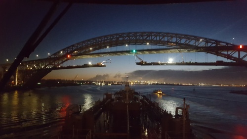
Lower Manhattan remains shrouded in darkness tonight..

We’re waiting for things to open up with precious little hope that it will be any time soon.  If the article below is any indication, it’s going to be a while before NY Harbor is moving much product at all.

Excerpts Re-posted without permission;

(Reuters) – full article linked here

REFINERY OPERATIONS

Phillips 66’s 238,000 barrel-per-day Bayway refinery in Linden, New Jersey, has already had its power restored, but a source familiar with plant operations told Reuters on Friday that the plant could be weeks away from restarting, due to heavy damage caused by salt-water flooding.

“A decision regarding when the refinery will be able to resume crude oil processing operations will be made once all assessments are complete,” the company said on its website on Saturday.

Phillips 66 said it had resumed fuel supplies “on a limited basis” from its Linden refined products terminal to wholesale customers late on Friday.

As of Friday, Hess Corp’s nearby 70,000-bpd plant in Port Reading, New Jersey, remained shut down. A company spokesman, Lorrie Hecker, did not report any change early on Saturday but said the company would give an update on operations later in the day.

Hess has used generator power to resume operating Port Reading’s truck rack, and marine operations there have resumed on a limited basis while an assessment of the factory is carried out.

State and federal authorities have been accelerating efforts to remedy fuel shortages. On Friday, the Department of Homeland Security issued a waiver to the Jones Act, allowing foreign oil tankers from the Gulf of Mexico to enter Northeastern ports; Cuomo, New York’s Governor, waived tax regulations on tankers in New York harbor; the Department of Energy lent 2 million gallons of heating fuel from its strategic reserve to the military; the Environmental Protection Agency waived clean diesel requirements in New York City and Pennsylvania. An earlier clean diesel waiver was issued for New Jersey.

Colonial Pipeline, a key oil product supply line to the Northeast, has resumed shipments at 700,000 bpd, or near full capacity.

“Gasoline, diesel fuel, jet fuel and home heating oil are being resupplied, but until customer terminals fully recover, it won’t be at the normal rates. Nevertheless, Colonial’s main pipeline into northern New Jersey is back at full operational capability, bringing nearly 30 million gallons of fuel a day to that region,” the company said on its website.

Buckeye Partners said on Friday its main terminal in Linden was reconnected to its power supply and fully operational by noon on Friday; and Magellan Midstream Partners restored full operations in Delaware and Connecticut.

Below is a list of refineries, fuel pipelines and ports impacted by the storm:

COMPANY PLANT CAPACITY (bpd) STATUS PBF Energy Delaware City, Delaware 190,000 Operations normal. PBF Energy Paulsboro, New Jersey 180,000 Operations normal. Hess Corp Port Reading, New Jersey 70,000 Shut down. Remained without power as of November 2. Truck racks and marine terminal operating on limited basis with generator power. Philadelphia Energy Solutions Philadelphia, Pennsylvania 330,000 Reduced rates. Both crude sections restarted at Point Breeze as of October 31. Company said on November 2 it would be back to normal schedules this weekend after delays in crude deliveries. Monroe Energy Trainer, Pennsylvania 185,000 Operated throughout storm. Back in full service as of November 1 though not at full rates due to maintenance overhaul. Phillips 66 Linden, New Jersey 238,000 Shut down. Could be weeks away from restarting due to heavy damage from salt-water flooding, source familiar said. Phillips 66 says power has been restored, but has not provided timeline for restart. Imperial Oil Ltd Sarnia, Ontario 121,000 Returning to normal service as of October 31 after power outage.

EIA REPORT ON STATUS OF TERMINALS

COMPANY LOCATION CAPACITY STATUS Colonial Pipeline Linden NJ Open 11/3/2012 Hess Groton CT 812,185 Shut 11/3/2012 IMTT Bayonne NJ 16,000,000 Shut; expected to reopen by next week-Macquarie 11/3/2012 Kinder Morgan Carteret NJ Seen ready to begin petroleum product movements in 24-48 hr 11/3/2012 Kinder Morgan Perth Amboy NJ 3,543,388 Seen ready to begin petroleum product movements in 24-48 hr 11/3/2012 Kinder Morgan Philadelphia PA 11,878,462 Open 11/3/2012 Kinder Morgan Staten Island NY 2,959,700 Seen ready to begin petroleum product movements in 24-48 hr 11/3/2012 Magellan Midstream Wilmington DE 2,842,000 Open 11/3/2012 Magellan Midstream New Haven CT 4,000,000 Open 11/3/2012 Motiva Bridgeport CT 1,290,000 Open with reduced operations 11/3/2012 Motiva Brooklyn NY Shut 11/3/2012 Motiva Long Island NY 222,000 Shut 11/3/2012 Motiva Newark NJ 1,113,000 Shut 11/3/2012 Motiva New Haven CT 1,600,000 Open 11/3/2012 Motiva Sewaren NJ 5,000,000 Shut 11/3/2012 Motiva Baltimore MD 1,100,000 Open 11/3/2012 Motiva Fairfax VA 360,000 Open 11/3/2012 Motiva Richmond VA 210,000 Open 11/3/2012 Motiva Providence RI 1,458,000 Open 11/3/2012 NuStar Energy Paulsboro NJ 90,800 Open 11/3/2012 NuStar Energy Linden NJ 2 of 8 truck bays open 11/3/2012 NuStar Energy Virginia Beach VA 40,000 Open 11/3/2012 NuStar Energy Dumfries VA Open 11/3/2012 NuStar Energy Piney Point MD 5,403,000 Open 11/3/2012 NuStar Energy Andrews AFB MD Open 11/3/2012 NuStar Energy Baltimore MD 832,000 Open 11/3/2012 Phillips 66 Riverhead NY Open 11/3/2012 Phillips 66 Tremley Point NJ Shut 11/3/2012 Hess Brooklyn, NY Expected to open soon 11/3/2012

FROM DOE: Global Partners Inwood NY Expected to Restart 11/2 11/3/12 Motiva Long Island NY Shut 11/3/12 Global Partners Newburgh NY Open, Expecting Deliveries 11/3 11/3/12 Global Partners Oyster Bay NY Open 11/3/12 Castle Port Morris Bronx NY Open 11/3/12 Gulf Oil New Haven CT Open 11/3/12 Schildwachter Oil Bronx NY Open 11/3/12 Hess Pennsauken NJ Open 11/3/12

OTHER TERMINALS IN NEW YORK HARBOR AREA

COMPANY LOCATION CAPACITY STATUS BP Products North America, Inc. New York, NY Harbor 53,000 Unknown BP Products North America, Inc. Carteret, NJ 1,445,000 Unknown Buckeye Terminals, LLC New Jersey, NY Harbor 4,000,000 Unknown Carbo Industries, Inc. Long Island, NY 5,900,000 Unknown Castle Port Morris Terminal New York, NY Harbor 846,000 Unknown Center Point Terminal Company New Jersey, NY Harbor 1,018,300 Unknown CITGO Petroleum Corp. Linden, NJ 3,669,250 Unknown Getty Terminals Corp. New Jersey, NY Harbor 1,018,300 Unknown Getty Terminals Corp. Bronx, NY 23,000 Unknown Global Companies, LLC Long Island, NY 104,200 Unknown Global Companies, LLC Long Island, NY 325,700 Unknown Gulf Oil, Limited Partnership Linden, NJ 568,374 Unknown Hess Corporation New York, NY Harbor 533,933 Shut Hess Corporation New York, NY Harbor 646,334 Shut Hess Corporation New Jersey, NY Harbor 5,961,000 Shut Hess Corporation New Jersey, NY Harbor 4,900 Shut Hess Corporation New Jersey, NY Harbor 579,619 Shut Hess Corporation New Jersey, NY Harbor 608,000 Shut Hess Corporation New Jersey, NY Harbor 1,689,000 Shut Kinder Morgan New York, NY Harbor 2,959,700 Unknown Kinder Morgan Liquids Terminals, LLC New Jersey, NY Harbor 7,542,619 Unknown Lorco Petroleum Services New Jersey, NY Harbor 476,190 Unknown Metro Terminals Corp. Brooklyn, NY 207,000 Unknown Motiva Enterprises, LLC New York, NY Harbor 50,000 Unknown Motiva Enterprises, LLC Long Island, NY 222,000 Shut NuStar Energy, LP New Jersey, NY Harbor 4,116,000 Unknown NuStar Energy, LP New Jersey, NY Harbor 340,000 Unknown Sprague Energy Corporation Long Island, NY 80,263 Unknown Sunoco Logistics Partners, LP New Jersey, NY Harbor 505,457 Unknown

PIPELINES, PORTS, TERMINALS, KEY POWER RESTARTS

* Colonial Pipeline, the 825,000-bpd conduit that ships fuel from the Gulf Coast to the East Coast, said it had restarted a large section of Line 3, its Northeast mainline that runs from Greensboro, North Carolina, to Linden, New Jersey, on Thursday. It also resumed deliveries at its key Linden junction to a connected Buckeye terminal.

“While Colonial’s pipelines and facilities were spared significant damage, many of the terminals in the Linden area will require days if not weeks to fully recover,” it said.

* Kinder Morgan Energy Partners, one of a handful of companies operating dozens of oil terminals and storage tanks that are critical links in the supply chain, said it should resume shipments from its New York and New Jersey terminals in the next day or two. Other operators have indicated they should be able to resume shipments as soon as power is restored.

* The storm damaged four diesel storage tanks at Motiva Enterprise’s terminal at Sewaren, New Jersey, and two of them leaked fuel into the Arthur Kill waterway, which separates Staten Island, New York, from New Jersey.

* Royal Dutch Shell said on Thursday that all of its New York borough terminals were still down. Its Shell-branded network was 84 percent open in Connecticut, 47 percent open in New Jersey, 62 percent open in New York and 83 percent open in Pennsylvania.

* NuStar Energy said on Wednesday that its Paulsboro, New Jersey, terminal was back in operation, but that damage assessment showed significant high-water damage to the marine and storage terminal. In Maryland, NuStar’s Piney Point, Andrews AFB and Baltimore terminals were all back in operation, the company said on its website. NuStar said its Virginia Beach terminal was back in operation, as was its Dumfries terminal, also in Virginia.

* Buckeye Partners said its main New York Harbor area terminal in Linden, New Jersey, had been reconnected to its power supply and was fully operational by noon on Friday. As of November 3, Buckeye has restarted all of its operations, according to DOE figures. The company is supplying jet fuel to the three airports in the New York City area.

* Hess Corp’s Port Reading terminal has used generators to resume truck rack operations, and marine operations have continued on a limited basis. Rack operations have also resumed at the company’s Bronx and Roseton, New York, terminals, but operations at the company’s other New York Harbor area terminals remain suspended due to flooding and power outages.

* Phillips 66’s Riverhead Terminal on Long Island has reopened and its Linden, New Jersey, terminal reopened at 2 p.m. on Friday.

(Reporting by Joshua Schneyer, Janet McGurty, Edward McAllister, Selam Gebrekidan and Jonathan Spicer in New York; Editing by Peter Cooney)
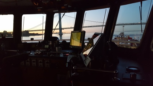
Slowpokes


Susan Clark, Ship Captain, Pilot, Crosses Final Bar.

I applied for my TWIC card renewal last week to take advantage of the “extended expiration date” price hoping that the bloody thing will die a quiet  and ignoble death before I have to renew it AGAIN.  Overall a very simple procedure.  I didn’t have to drive anywhere and I paid with my credit card.

I’m happy to report I have already received  my notice that the card is ready, AND in less than a week.  I pick it up in a couple of days.  Nice.

Call the TWIC Center at 1‐866‐347‐8942, Mon–Fri, 8AM to 10PM Eastern, hang on the phone for what feels like a week and a half and you’ll finally get hold of a really nice person who will actually do something for you!

I’m including the notice that was originally on the TWIC site (of course their site’s link is broken so I found it elsewhere).  You’re welcome.   TWIC Expiration Policy Bulletin 06-14-2012 530pm hg (2)


As a followup to this little note;  After being notified by email that my new EED TWIC was ready to be picked up, I made my appointment in Elizabeth, N.J. on the TSA website.  I showed up early, provided a fresh index fingerprint and pin, and I was out of the building in less than 15 minutes.  Just like that, $60.00 and three more years added to my first expiration date.

A busy windy day…..

So far, September has been kinda quiet.  Except of course for the howling we can hear from folks trying to fill up their cars for an early leaf peeping tour at over $4.50 a gallon for gas (Still happy about that Land Rover’s mileage?).  There’s a good reason why the prices are spiking right now.  The suppliers are slowing their refining capacity for gasoline and ramping up their heating oil production to meet this winter’s anticipated demand.  It’s their annual changeover kids!

Of course what that means to you and me is that we wait for gasoline to be made, sometimes for days.  We end up sitting waiting for the product to become available.  High demand, low supply….see what’s happening here?  It’s not that they don’t have the means to make it, it’s that they aren’t making enough of it.  Tugs and barges are lined up like Carter era motorists waiting for their turn at the pump.  It’s not some evil plot, the changeover happens every year about this time.  The difference is this year the prices are so freakin’ high YOU noticed.

So hang in there kids, the prices will come down.  Not as much as you’d like, but they will come down.  So, in order to ease the blow I’ve posted some photos of my local hangout here in Bay Ridge Anchorage.  I know, not much comfort there but I didn’t tell you to buy that 12mpg SUV did I?

The industry continues to drag itself into the modern age when it comes to licensing and renewals for the certificates we all need.  I recently read of a course offering that will save some money and make a radar renewal a bit more convenient, I hope.

Calhoon MEBA Engineering School has announced a program that will allow you to study online for your radar re-cert and then travel to a satellite exam center to test.   As far as I know, it is available to all with payment, not just the MEBA membership.  I have no direct knowledge of how well this works or doesn’t.

I just had a chance to look this over this morning and believe I may take advantage of this in 2014 when I’m up for renewal.  Presently the quoted $235.00 price is reasonable when you factor in the ever dwindling amount of brick and mortar schools that offer this course in reach of most candidates.   I know I’d rather avoid a five hour round trip to my nearest maritime academy for what amounts to a 10 question quiz.

We all know the one day radar renewal course is actually a practice session in the morning and an exam after lunch.  You have to show up ready to test, you either pass or fail.  If you fail you’re given a price for the extended renewal course and you’ll need to re-test at the end of that.  Add three days plus expenses to the total.

The USCG REC’s do not offer the tests anymore and haven’t for quite a while.  You’re forced to pay and attend an approved “school” and get your cert.  The classes offered invariably run from the full five day soup-to-nuts class to variations of the renewal curriculum anywhere from one to three days.  Add lodging, meals, gas and tolls and it can add up to a sizable chunk of change.

The online course touts its unfettered access to instructors and the benefit of studying online at your leisure.  The course provides a nice radar emulator which does a good job of presenting a radar screen and target advance in real time.  All the forms you’ll need for plotting are available and are shipped within a day of payment.

This is what sells the program; You then can schedule the test near your home using the Prometric Center Locator.

You make an appointment and can show up ready to test without feeling rushed or unprepared.  Not everyone will have the benefit of a testing center inside of fifty miles, but a lot of us will.  If nothing else, it’s an option.

To see if the offering will be convenient for you, check your proximity to a testing center , select “locate a test center” and select radar observer re-certification online.  Select your location from the drop-down menu to find a test center.

Just thought it sounded like something worth checking into.  Anyone with direct first hand knowledge is welcome to add what they feel is relevant.

You will find this link takes you to the AWO’s page and form for submitting this request to our representatives in Congress to direct the TSA to eliminate the “second trip” to the TWIC centers we all know and love.  Take a minute and send in your opinion.  It’ll do us some good, save fuel, and make the TSA a better agency.  (choke) Just kidding on the last part….

http://capwiz.com/americanwaterways/issues/alert/?alertid=60534536

Urban harbor/commercial waterway kayaking has become an issue and it’s not just me who’s noticing it these days.  See this article in the W.S.J.

It’s been a couple of years since I was working on a conventional tug.  I’ve been in the ATB world up to my eyeballs for the last eight years and I look at these temporary duty assignments with a mixed view.  Although I love getting back to basics and exercising my skill sets, nothing grates on me worse than having my boat in the yard and me not being there to get the things I need done “my way”.

That said, I can’t worry about two boats at a time so the focus is presently on my current assignment, the tug Franklin Reinauer.  So named for one of our late founding fathers and built for the company in 1980 or so.  Not a large tug by today’s standards but still a little bulldog of a boat.  She’s equipped with a nice little tow winch and a decent amount of horsepower.  A five man crew and enough work to keep time flying by at a respectable rate.  With quarters a lot tighter than those on the Nicole, she’s kinda tiny really but comfortable in a cozy kind of way.  Really cozy once you get in the upper house, basically a box on a stick.

Not so long ago she was one of the coast boats.  Making runs anywhere and everywhere towing up to 70,000 bbl barges.

The view from the Franklin’s upper house of the RTC 28’s notch…

The work is now mostly assist work with an occasional barge delivery in either Newtown Creek, Jamaica Bay or Sewaren NJ.  We made a trip to each during my few days aboard with a surprise or two.

Surprise number one; It turns out is that Newtown Creek now has a community of sailboats moored along the creek’s crumbling bulkheads outside of the Pulaski Bridge, I can’t help but doubt they’re costing the boat owners anything in the way of dock fees.  It’s more than a bit amusing to me that it’s becoming a mecca for gypsy boat owners finding cheap wharfage for an expensive hobby.  I hate to see what might become of these opportunists when a windy day and breakaway scow have their way with their fiberglass hulls.  I can just imagine the splintering sound of hulls under the bow of a runaway 300 ton scrap scow.
Surprise number two; Who knew that scrap yards harbored statuary?  The picture of a few (recovered?) statues lining the wall of the reclamation center in Greenpoint.  Very artsy.  And finally, no real surprise to find that small vessels still insist on taking the same draw of the Jamaica Bay Subway Bridge as an inbound tow (with a fair tide).  Even if they’re law enforcement, some things never change.
 

This slideshow requires JavaScript.

I expect to be back in the ATB world soon, until then I’m enjoying my little piece of regular tugboating immensely.  I especially liked nursing a light barge in push gear across Coney Island Channel this morning.  I had almost forgot what it was like “sweet-talking the tow” across the channel when a swell was running.  Good stuff.

Somebody likes me….

As a blogger for the last couple of years no one is happier to see when someone has subscribed to my blog. Everyone can agree with that statement. In the last few weeks, I’ve been “followed” and “subscribed to” by a clever fellow named…you guessed it “Someone”.  Someone apparently believes he or she needs to remind me I’m being followed, frequently. Okay, duly noted.

10,000 comedians out of work and I get this guy. I mean, it was kinda’ funny the first 2 or 3 times. But really, a few more reminders and you’re a stalker. So, since I’m feeling a bit worn out from swinging on an anchor in the Gulf of Mexico for the last week I will acknowledge your devilishly clever humor and grant the attention you seek. Since Paul B isn’t feeling so hot (feel better Paul) why don’t you  stalk Kennebec Captain  for a while, he’s really a much better sport than me.

BTW Kurt, you’re welcome…. ; )

A.I.S. Changes

In spite of the many things that drive us to distraction when it comes to USCG policy letters sometimes the boys get it right.  There was a small hitch in the A.I.S. regulations that proscribed tugs with tows ahead or alongside from indicating that distinction via their A.I.S. transponders.  They were strictly limited to either being a light tug or towing in excess of 200 meters.  Now the realities of A.T.B.s and hip tows have been recognized.  The new code “22” is for vessels pushing ahead and  A.T.B.s.  Up to now we (the A.T.B.fleet) had been broadcasting true “length overall” when underway and in due course received a letter telling us to cease and desist, well now we’re legal.  Read on;

http://www.navcen.uscg.gov/pdf/AIS/USCG_AIS_Data_Encoding_Guide-120104_2.pdf

2011 in review

The WordPress.com stats helper monkeys prepared a 2011 annual report for this blog.

Here’s an excerpt:

The concert hall at the Syndey Opera House holds 2,700 people. This blog was viewed about 23,000 times in 2011. If it were a concert at Sydney Opera House, it would take about 9 sold-out performances for that many people to see it.

Click here to see the complete report.

Happy Thanksgiving

Like many us I am working the holiday this year.  It’s fortunate that the weather has cooperated and served up a crystal clear early morning and provided us with a sunny transit in Delaware Bay’s upper reaches and the C&D Canal’s meander.  Nothing in particular stands out about the trip, it was just a picture perfect ride.  I couldn’t not take the video.

My crew and I wish you all a healthy, happy holiday season. Wherever you may be spending it, enjoy.

Daylight and clear weather, the perfect combination for making a transit of Chelsea Creek in the last days of autumn.  The remains of the old bridge at Chelsea Street are still an issue, very narrow and not yet gone.  When the removal of the old bridge’s bones is completed, this will be a cakewalk.  But for now, the Chief Mate gracefully completed an uneventful and slick passage of this tight and challenging draw.  It was a pleasure to watch, maybe you’ll think so too..

Kinda sad really.  The quintessential American icon got little if any press attention.  No big parade of tall ships, no speeches of note.  Just a beautiful display (presumably put on by the Grucci family, I’m not sure if it was their work).

The one thing that matters (to me anyway), I was there.  25 years ago I was there for her 100th.  Doesn’t seem like it, but alas it’s true.  Only difference was then I was towing the fireworks and got THE front row seat.  Even better, my family was aboard for the night’s events and we won’t ever look at fireworks the same way.

I submit this little bit of video taken from a vantage afforded by my spot in Bay Ridge Anchorage that night and a new cell phone that shoots amazing video. (check out the difference in quality starting at marker 00:00:29)

Happy Birthday Lady Liberty, it was a grand.

Sea Cruise..

The bluffs of the Atlantic Highlands become visible at about 40 miles on a clear day, our home port is not far away.

This was my view from the pilothouse this morning as we approached Sandy Hook Channel after making a trip to points south this last week.   A long voyage coming to a close after many long days at sea with little to do but steer a course and plot positions, one watch after another.

Our last voyage was from the Port of New York to Port Everglades Florida with the first leg completed in just over four days and kind of remarkable in that we had a surprisingly pleasant trip past Cape Hatteras both ways.  The weather was rainy and stormy on our way “down the beach”, but the seas weren’t rough and the thunderstorms we witnessed were just freakin’ spectacular.

I never get tired of seeing a show of lightning that streaks light across miles of sky for as far as the eye can see on a horizon that is impossibly far away.  The sky just seemed incredibly huge as we sailed down the coast.  The atmosphere was clear enough that we could see stars above the thunderheads 40 miles away with bolts of lightning weaving and darting through massive formations.  We had a lightning show every night from Port Everglades to Baltimore, awesome.  I wish I had a proper camera to have taken pictures of what we were seeing at night.

Cape Canaveral 25nm to the west.

Miles and miles.

Overall a voyage of nearly 2200 miles delivering to two ports along the way.  First stop was Port Everglades, then on to Baltimore to complete the delivery of our cargo.

A round trip of 2200 nautical miles(roughly 2500 statute miles), about nine days underway time plugging away at an average of 10 knots(11.5 mph).  It went from balmy temps to hot and steamy to raw and chilly in the span of a few days.

Standing the watch. Cape Canaveral to the west

Blue as can be.

We sailed 14 degrees of latitude south and 7 or so degrees of longitude west and back again.  We rode home on the eddies of the Gulf Stream in the bluest water you could imagine.  (Think of a brand new pair of dark blue denim jeans, that color.)  We covered the coast from Sandy Hook to Port Everglades then back up to and through the entire length of Chesapeake Bay, C&D Canal, Delaware Bay and then up the Jersey Coast to Staten Island where we now sit loading our next job for Providence Rhode Island.  We sure do get around.

We were “incommunicado” for most of the trip due to our distance offshore.  Our sat phone and sat-comm systems (reserved for company communications) were our only regular contact with shore-side for a good deal of our trip.  But lacking cell phone service and (of course) internet was a pleasant respite from the “always connected” way of life.  It gets quieter, nice.  The points along the trip that have fringe coverage near Hatteras and Canaveral  allow for a quick call home if you catch the right tower at just the right time.  But mostly it’s a “no service” situation until you’ve closed on the beach near Jupiter Inlet or Palm Beach southbound and Chesapeake Entrance northbound..

New York City from sea

A beautiful trip but a rare one as well.  One doesn’t generally get a round trip past Hatteras with near flat seas both ways.  I’m sure we’ll pay the piper somewhere down the line.  Of that I am certain.

On September 11th 2011  I didn’t  tune in for the network “memorials” to drag my soul through it all over again.  It’s enough to have lived that day once.

I mourn the losses my friends and neighbors suffered and the harm it has done to my own family.

I am pissed that we’ve spent so much of our time and a trillion or more dollars so many thousands of miles from our shores chasing human garbage.

I am saddened by the losses our armed forces and their families continue to suffer in the name of National Security, I honor their sacrifices.  I can’t thank them enough.

I remember when the towers were nearly complete.  I watched from my hometown on Raritan Bay as they reached their apex.  They were readily apparent on the horizon.

Later on as a young deckhand, I helped deliver the construction materials that would become Battery Park City.

I clearly remember the vista the observation deck afforded me, my wife and my young daughter that evening in October 1984 when it was so clear at dusk you could almost see forever.  The city scape looked like a gilded scale model.

I was part of the Statue of Liberty 100th Anniversary Celebration in 1987 and had the duty of towing one of the many firework barges the Grucci Family had set up for an unbelieveable show.  I’m spoiled on fireworks forever.  I remember how during the show the reports from the shells echoed in and around the towers as we held station at the foot of the South Tower .

I remember where I was when the unimaginable occurred.  My “where was I” story isn’t worth telling compared to so many others.

I’m still in awe of how the New York Maritime community was able to evacuate more than 500,000 people in about nine hours from lower Manhattan.  It’s amazing how so many people were taken to safety in such a short time.  (During WW2, the Dunkirk Boat lift took nine days to move over 338,000 troops from the coast of France.)

No I didn’t need to watch it happen again, I haven’t forgotten.


A kick in the ass…

I recently received word from a former AB/Deckhand of mine that he is now the newest Captain in our fleet.   He used the above header in a thank you note for my pushing him to go for his license.  The  “kick in the ass” (as the phrase is coined) is the advice given someone with recognized talent to do what’s necessary to move up off the deck and into the pilothouse.

All of us, no matter how long we’ve been in the industry have been given (mostly unsolicited) advice on how we should either advance or abandon our ambitions.  Some folks are suited for the work a tugboat demands and some are better off staying ashore and getting into the regular “nine to five” lifestyle.  For those who adapt and excel at the job it’s not unusual for the older men to start encouraging, cajoling or insisting the deckhands with obvious talent “go for their license”.  I was subject to this “kick in the ass” and have kicked a few myself.

Some guys procrastinate while others take the bull by the horns and get it done.  The motivation for advancing is usually monetary, why work on a boat and not make the most money you can?  You’re here anyway, you might as well pull down the big bucks.   I’d like to think it’s more than the motivation of what collecting a few more “Benjamins” brings, I’d hope it’s also the sense of accomplishment that follows a determined effort to advance one’s career..

After hearing it enough, he did.  He studied, passed, practiced and excelled.  I had no doubt that he would. He’s one of those people who “get’s it”.  After having him as my senior deckhand for so long I was glad to see him move on to bigger and better.   I didn’t want to lose him as my senior guy on deck, but you gotta let’em go…

He put in his time as a tug mate on various tugs and was recommended for promotion by no less than three tug masters.

I have to say that I’ve taken a good deal of pride in the fact that I was part of  his process. I have no doubt he’ll be kicking some ass of his own.

Congratulations Mike.  To quote Michael Stipe of R.E.M., “Welcome to the deep end”.

As rough as a lot of folks had it with Irene, I was impressed with how well most of the metropolitan area O.E.M.’s had things under control.  Well, as much control as you can have in a hurricane.  The unprecedented shutdown of mass transit in NYC and the evacuations initiated in anticipation of this storm were well executed and laudable.  So many times our elected officials are caught flat-footed when Mother Nature inflicts her wrath, thankfully we had the time to prepare and make amends for past mistakes.

We’re extremely fortunate that the storm was downgrading as it reached the tri-state area.  A lot of low-lying areas suffered dramatic flooding and wind damage but our little anchorage was relatively quiet except for a couple of dragging anchors and a  couple of close quarter situations when one vessel would swing into the circle of another.

The first indications of clearing began late in the afternoon and progressed to the point where we could get moving again after a long 4 days of waiting.  This video is just a small sample of how it looks to us as the anchor comes up into the hawse and we turn southbound for our discharge port.

Some folks suffered little to no effect while others lost everything.   The season for crazy weather is far from over, hopefully this will be the worst we see this year.

I’m just glad to be moving and grateful to see another day.

Condition Zulu; My morning watch starts dark, gray and windy.  We’re anchored and holding well with 4 shots in the water.  With the barometer at 983mb, temp 65f and heavy rain the winds are gusty but they’re not anywhere near hurricane strength right now.  The TV news is calling for the worst of the storm to hit this area between now and 0800.  I hope to be able to get some video of the eye’s approach, and that’s only if I don’t have more pressing concerns by then.

Why the Hell do newscasters think they need to stand out on a windswept street corner during a heavy weather event?  It strikes me as being about as idiotic as you can get.  Is the producer trying to get rid of their “meteorologists”?  They’re standing in 40-50kn winds telling you not to try and stand in 40-50kn winds.  I don’t wish them harm, but maybe if a billboard or two flew by their “perch”, maybe they’d get the message.

So far only one unit (that I know of) dragged last night in our little piece of the river.  The tug and light barge got caught in a heavy gusting easterly and ended up against the bank under the Palisades.  No blood, no foul…they were able to get free and head up to a spot up off Hastings, NY.  As far as I know they’re anchored and holding.   We’re at a respectable 23′ draft and don’t suffer the wind’s sheering effect as much.  It’s good to be deep.

We’ve just about finished swinging to the incoming tide and the wind is howling a bit more often .  I’m setting up my camera now so I don’t have to mess with it later, I’m hoping for some decent visibility.  I’m also hoping my truck doesn’t end up floating away into the Kill Van Kull.

The barometer is starting to fall ever so slowly as the main rain bands approach my little piece of the river.  We’ve slipped a little more anchor wire for a longer rode in anticipation of the forecasted easterlies.

We’re at 1005mb ( a drop of 3mb in the last hour) and 66f.  Squalls are starting to come through with greater frequency.  No heavy wind yet, easterly about 10-15kn..

Fog then rain then clear.  More later.

So it begins…

Waiting for a gal named Irene.  She’s got attitude and no mercy for anyone foolish enough to get in her way.  Kinda like putting yourself between a crowd of shoppers and the front door of the Super Walmart on double coupon day.

Sitting and waiting isn’t too awful bad, here the calm before the storm.   As she gets closer to the Greater New York Metropolitan area we’ll have increasing rain and wind that will make staying at anchor an interesting exercise.  With the amount of wind we’re expecting we’ll have the maximum amount of anchor wire we can safely slip out and not allow ourselves to drag over the flats on the Jersey side or the wall on the Yonkers side.

We have a lot of company.  At least a dozen tug and barge units are shoe-horned into the anchorage from the George Washington Bridge to Dobbs Ferry Landing.  Not exactly inside the charted anchorage, but deep water and good holding ground.  No one will be allowed in the NY Upper Bay or Gravesend Anchorages after this afternoon, all ships have been ordered to sea.  The “Staying in Port” form for us has been filed and we’re one of dozens of units that have or will drop the hook in the Hudson from Yonkers to Albany to wait out the storm.  Alas, my truck sits in Port Richmond and exposed to the predicted and imminent tidal surge. Sigh..

So we sit waiting.

I can’t resist a good photo op.  I wanted to catch the sunset with the Verrazano Bridge in the frame when I noticed the Vane Brothers tug “Wye River” with his tow outbound for sea .  I can’t decide which photo I like best just yet so I’m posting all three.

It’s a regular occurrence, we take the novices aboard and get them oriented. We show them the pointy end (the bow), the port side rail, the starboard side rail, and then the not so pointy end (the fantail) all the while extolling the virtues of remaining within those boundaries, no swimming without authorization if you please. We teach them the basic chores and how we want them done, and then try to imbue them with our knowledge and experience so that they too will eventually be equipped to think and act as a full share member of the team. We are keenly aware that until they’ve got some time under their belts we’ll need to coddle, cajole, and harangue some of these hopefuls in order to keep them from killing themselves or anyone else on our watch. The entire crew is involved.

One of the many questions asked by newcomers to the trade is; “What do I need to know right out of the gate?”. In an effort to clear up the mystery, here’s the first few things a new hire should commit to memory as he or she steps aboard the tug (or any work boat) for the first time.

Welcome aboard.

tugrichardk2

The Tug Richard K , shifting at Standard Tank in Bayonne NJ photo by Capt J. Brucato 1979

The first thing you need to know is that working on a tugboat is a real job, you can’t fake the proficiency you’ll need to survive. The environment is dangerous and demanding. Learning on the job is traditional and training new hires is a common practice for us, we expect it to take some timple.

We prefer that you have no experience at all, it’s easier for us if you have no bad habits that we’ll need to overcome. If you’ve been fortunate enough to graduate from an academy please keep in mind we don’t need to hear how smart you are, you’ll need to demonstrate your intelligence and learn what we teach you.

Please know that we won’t ask you to do anything that we ourselves haven’t done. We know how to get you up to speed and you’ll either learn to follow orders, or end up “back on the beach”. After that the next thing you’ll learn may well be when to say, “Ma’am, do you want fries with that?”. If you want the job, pay attention.

No one expects you (as a novice) to know what is expected when you step aboard a boat to work for the first time. If you’re lucky enough to have scored a job with a tugboat outfit, there are many things to be learned but, before you’ve stepped aboard the one thing you should have already mastered is your manners.

Report to the captain and show him your paperwork. Although the atmosphere on a tugboat is less formal than what you would find sailing “deep sea”, you would do well to remember that the Captain is not your buddy, pal, father, friend, or peer, he’s the Boss, be prepared to show him respect.

Listen carefully to what you’re told and find your room and bunk. Introduce yourself to your new shipmates.

At this point it’s worth mentioning that you should pay particular attention to practicing good hygiene habits. The tight living quarters on a tug are tough enough, we don’t need to put up with your funk. Flush and wipe the bowl if your aim is bad. Wipe out the sink, no one wants to see globs of your toothpaste floating around the drain or splattered on the mirror. Make sure you always clean up after yourself, learn how to change a toilet tissue roll, your Mama ain’t here.

Keep yourself and your work area clean and orderly, and before you handle any food whether you’re making a sandwich or starting dinner, wash your hands.

Find out what your responsibilities are in an emergency, check the Station Bill for your duty assignment during drills and emergency response. Learn and remember the location of all the emergency equipment on the boat, you’ll be expected to know how everything works in short order. Pay attention during the drills. You’ll be shown what everything is and what it’s called, your task is to memorize it so you understand what you’re being told.

You’ll be assigned a watch. Get out of bed when you’re called for the watch, don’t try to catch “just 5 more minutes”, we’re not your personal snooze alarm. You’re expected to show up a few minutes or so before you’re due on watch. Napping on watch is forbidden.You should be properly dressed, fed, sufficiently caffeinated, and ready to work.

Showing up prepared to work “properly equipped” means a deckhand should have a work knife in his pocket or on his belt and be wearing a good pair of work boots and gloves, sneakers don’t really cut it. During your first tour you should keep a list of the items you’ll need to fill out your gear for the next hitch. Like a better set of rain gear, boots, glove liners, etc.

If you don’t understand something, ask. Common sense (while not so common) is second only to showing respect for your shipmates and vessel. That includes pulling your weight and respecting the privacy of others. Like I said, good manners.

mvc-034s

“Crossing the table”, towing a ship out of the graving dock in Bayonne Shipyard

You are here to work, put the cell phone, Ipod, and laptop away until you are off watch. You aren’t here if you’re on the phone or whatever.

Practice, practice, practice your line-handling. The only way to become proficient is to take a lot of throws at bitts and cleats. Every deckhand breaks in the same way by throwing lines on the fantail. The exercise isn’t all that different from a hundred years ago, it’s a rite of passage for all of us. We’ve all done it and I can assure you it’s not about strength, it’s about technique and finesse. “It’s in the wrist”.

These are just a few of the things you’ll be expected to do once you step aboard. Remember, there are no stupid questions except for the one you didn’t ask.

You only get one chance at making a good first impression and if you show us you’re ready and willing to learn, we’ll be more than happy to teach you everything we know.

By the same token, if for one minute we get the idea you’re trying to blow smoke up our ass or just trying to get away with the least you can do, you’re done. Then we’ll find someone else who’d like to earn $45,000.00 per year + benefits to start, with no experience required. Comprende?

Do you want maritime more understood and appreciated? Do you want a source of trained mariners?

If yes, make a year-end donation to PortSide NewYork and ask your company, friends and coworkers to do the same.  Info at www.portsidenewyork.org/donate.

Here are reasons for your support, accomplishments and financial urgencies:

PortSide lost $55,000 in anticipating City funding this year due to covid’s effect on the budget, and our ship insurance is set to go up 100% from $9,000. This crisis calls for your urgent support.

Accomplishments:

  • PortSide made the oil tanker MARY A. WHALEN a beloved ambassador to the working waterfront.
  • We educate the media, elected officials, government staff, schools, students and the general public about maritime. We fight for NYC’s waterfront to have more maritime uses.  We are a respected voice in making that change.
  • We’re in talks with an out-of-state program to partner and launch a NYC commercial maritime training school. This would have an affiliated nonprofit program to train disadvantaged youth as deckineers, and the commercial program would generate revenue to support the nonprofit effort. We can build on our experience training youth on our ship during high school internships.
  • PortSide just got a vintage engine from Missouri which can restore the one in the MARY.  With a working engine, she can be a training ship. 

PortSide needs support for programs and to get the ship hauled out for maintenance and engine restoration work.  Please donate via www.portsidenewyork.org/donate.

We take credit cards and Venmo, checks written to PortSide NewYork (mail to 190 Pioneer Street, Brooklyn, NY 112331).

We have a fundraiser on Facebook you can share at https://www.facebook.com/donate/133937541605440/10214673036178223/

Thanks!

Carolina Salguero

Founder + Executive Director

PortSide NewYork
aboard the tanker MARY A. WHALEN

190 Pioneer Street

Brooklyn, NY  11231

917.414.0565
carolina@portsidenewyork.org
www.portsidenewyork.org

www.redhookwaterstories.org

SAFER SEAS-11.01.2018The latest NTSB document on vessel casualty investigations delivers insights into the chain of errors that result in the bad things happening.  Read, explore and appreciate the observations made and the cost of these error chains.

https://earth.nullschool.net/#current/wind/surface/level/orthographic=-75.24,32.17,2341/loc=-71.869,40.838

Someone was going to do it sooner or later.  This could be really helpful, especially during hurricane season.